Map of Lake Forest, California
Our map of Lake Forest shows its highways and roads connecting everything. Neighborhoods wind around forested parks and man-made lakes.
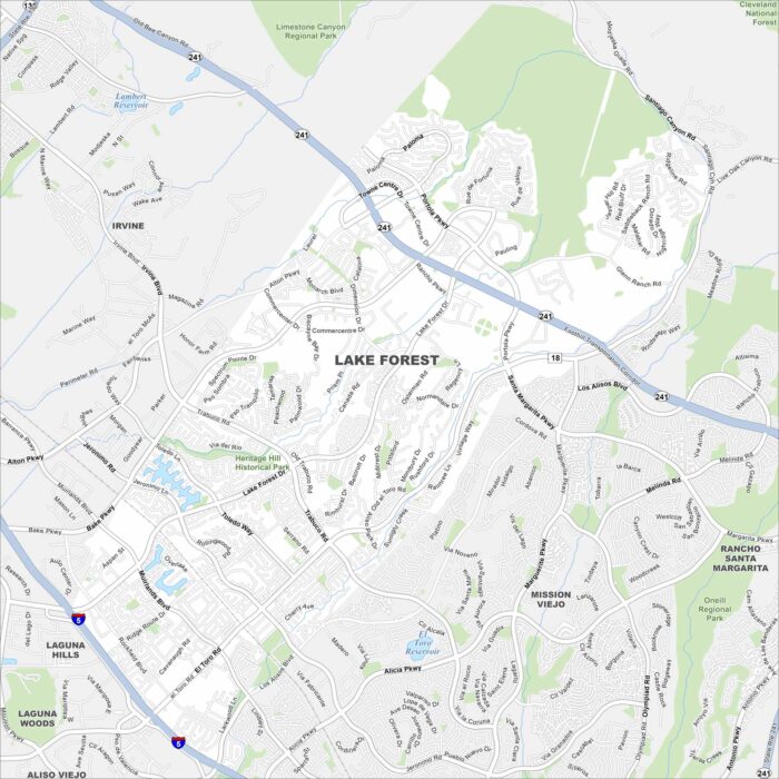
Our map of Lake Forest shows its highways and roads connecting everything. Neighborhoods wind around forested parks and man-made lakes.
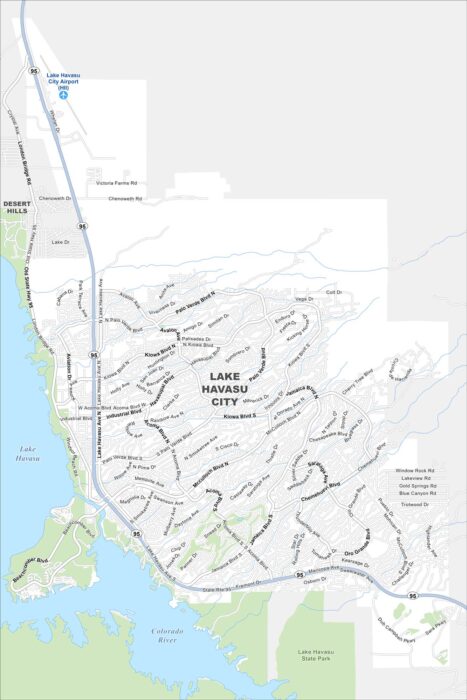
Lake Havasu spreads blue across the map on the western side of our map. The London Bridge marks the city’s centerpiece.

This map shows a curving street layout designed like a “tree”. While waterways flow through town, highways connect it to the Gulf Coast.
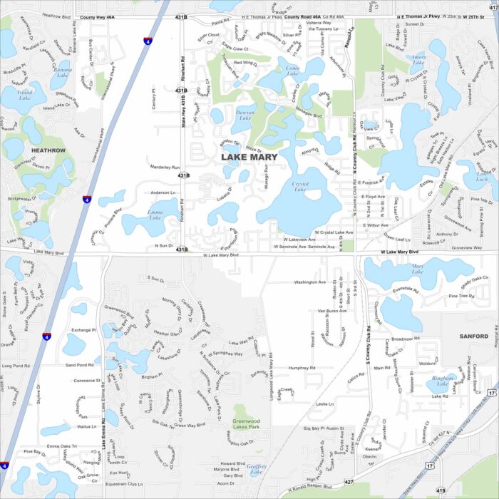
Lake Mary’s map reveals clusters of lakes scattered everywhere. Residential neighborhoods fill a lot of the spaces between.
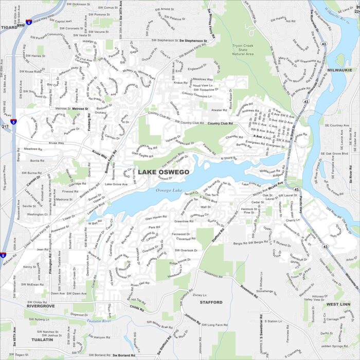
The city of Lake Oswego curves around Oswego Lake. This map highlights the lakes, rivers and winding roads. Portland lies just to the north.
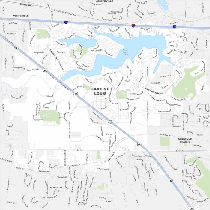
Our Lake St. Louis map shows the twin lakes that give the city its name. Neighborhoods wrap around the shoreline in sweeping curves.
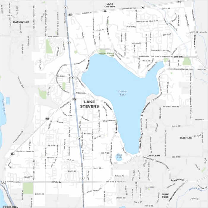
Lake Stevens dominates the center of the map. While subdivisions circle its shoreline, mountains rise in the distance to the east.
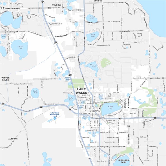
Find Lake Wales sitting among central Florida’s chain of lakes. This map highlights US Highway 27 that runs north-south through the city.
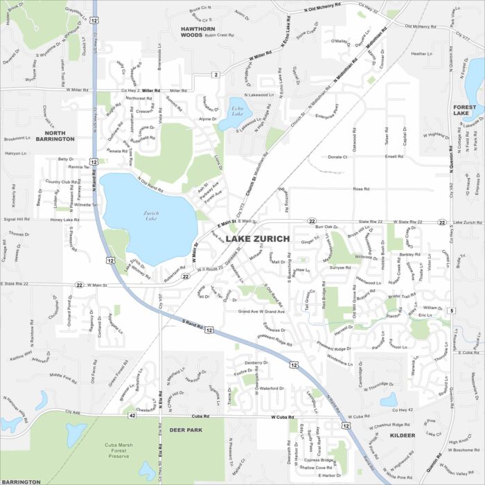
Lake Zurich fills the middle of the map with water. Suburban streets travel outward from the shoreline. Highways link it back to Chicago.
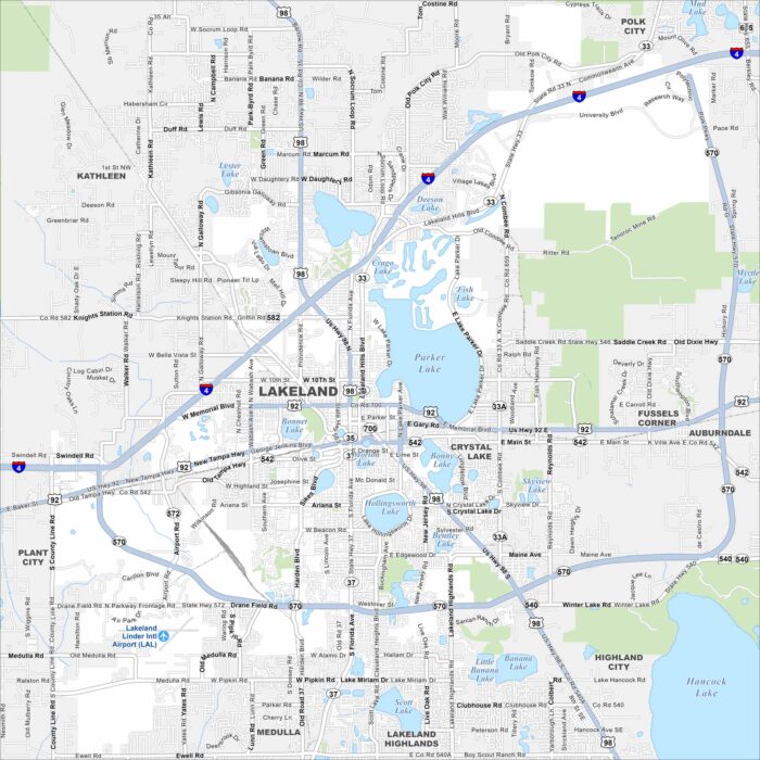
Our map of Lakeland shows its namesake. That’s right. Lakes are everywhere! The city spreads between Tampa and Orlando.
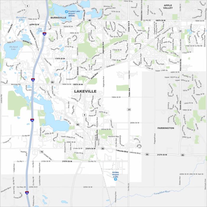
Lake Marion and Orchard Lake stand out on our map of Lakeville, Minnesota. Subdivisions fill the space between farmland and water.
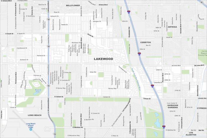
Our map of Lakewood, California reveals a dense residential road network. Freeways border the city on nearly every side.
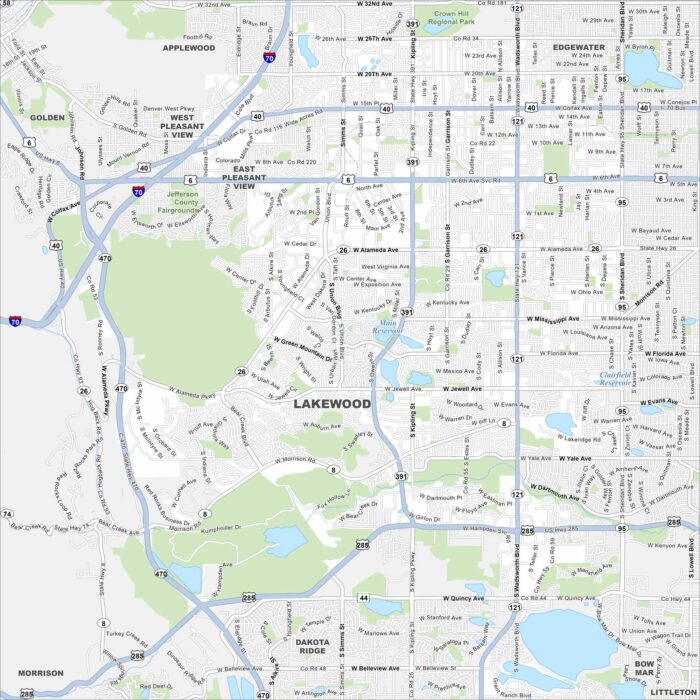
Mountains rise just west of Lakewood. This map of Lakewood shows highways streaming toward downtown Denver.
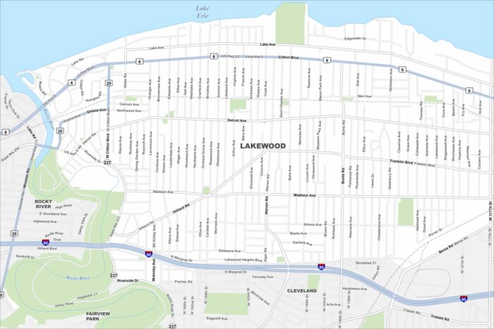
Tucked along Lake Erie, Lakewood stretches in a narrow band. The map shows streets running right to the shoreline.
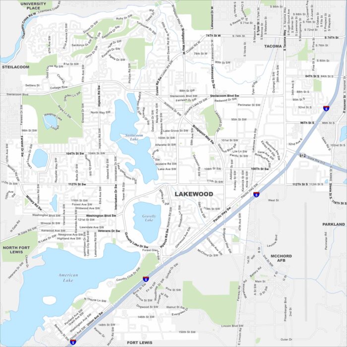
Lakes cover the map all around the city including Steilacoom, American, and Gravelly. Suburban streets travel between them.