Map of Goldsboro, North Carolina
Goldsboro stretches along the Neuse River in eastern North Carolina. It’s tied closely to Seymour Johnson Air Force Base.
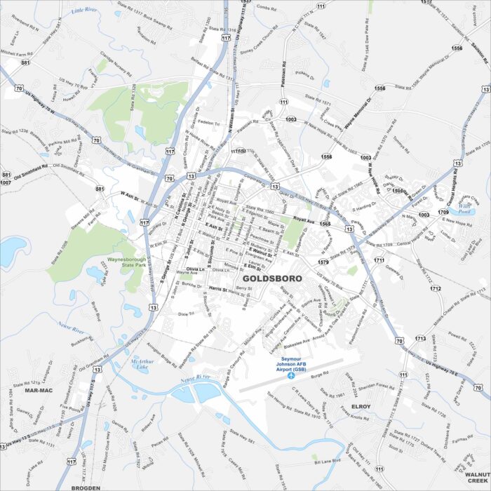
Goldsboro stretches along the Neuse River in eastern North Carolina. It’s tied closely to Seymour Johnson Air Force Base.
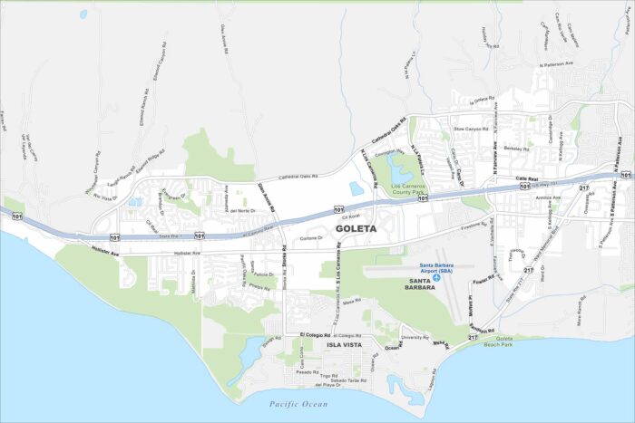
Goleta lies on the California coast just west of Santa Barbara. It’s quieter than its neighbor but still has beaches and farmland on the map.
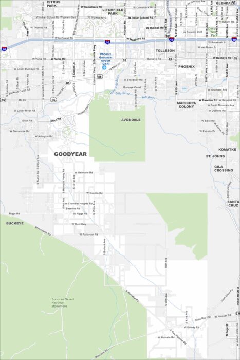
Our map of Goodyear, Arizona is a tale of two sides. Phoenix fills the top half. But the Sonoran Desert National Monument occupies the south.
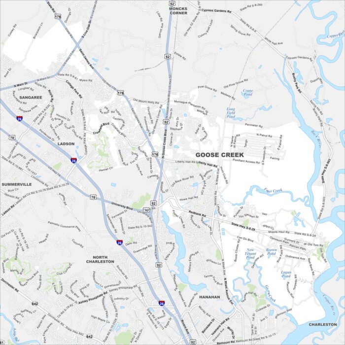
Goose Creek is outside Charleston, with rivers and creeks running nearby. It feels suburban but stays connected to the larger metro.
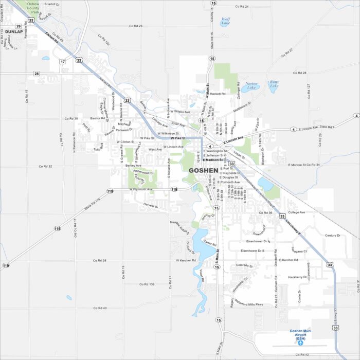
Our map of Goshen highlights it in northern Indiana near the Elkhart River. The river curves through downtown and neighborhoods.
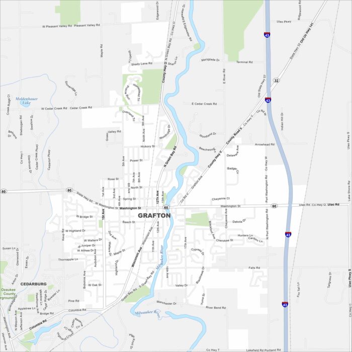
Our map of Grafton shows it north of Milwaukee along the Milwaukee River. The river winds through, shaping its layout.
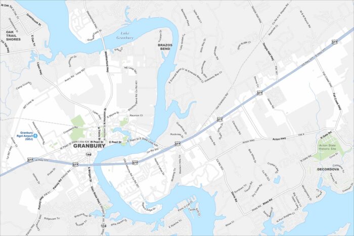
Granbury is a lakeside city in north-central Texas. Our map highlights Lake Granbury, local parks, and the town square.
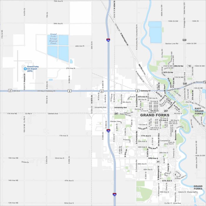
Our map of Grand Forks shows the Red River running along the border with Minnesota. Neighborhoods spread out from the downtown core.
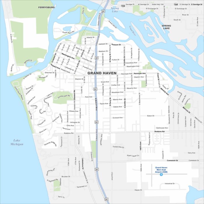
Check out our map of Grand Haven on Lake Michigan’s eastern shore. You’ll see the Grand River flowing into the lake, along with marina areas.
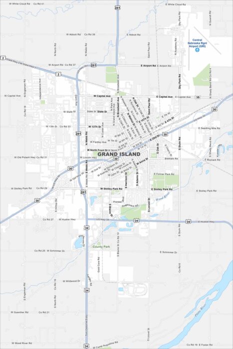
Grand Island is in central Nebraska along the Platte River. Our road map displays highways crossing through the city and the nearby waterway.
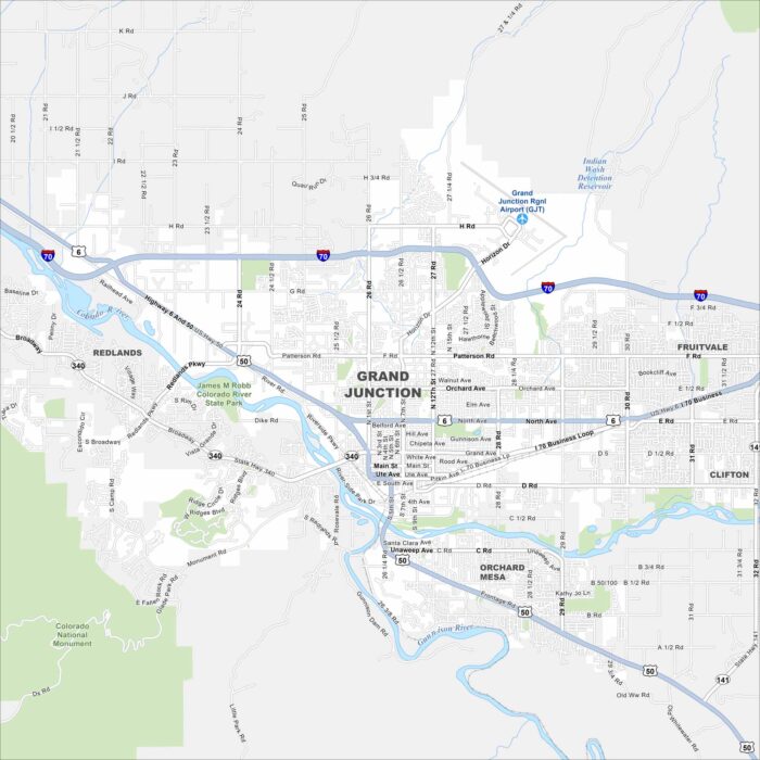
Explore our map of Grand Junction in western Colorado. This city sits at the meeting of the Gunnison and Colorado Rivers.
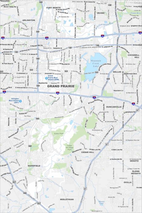
Grand Prairie is located between Dallas and Fort Worth. This map shows main roadways, local lakes, and residential areas.
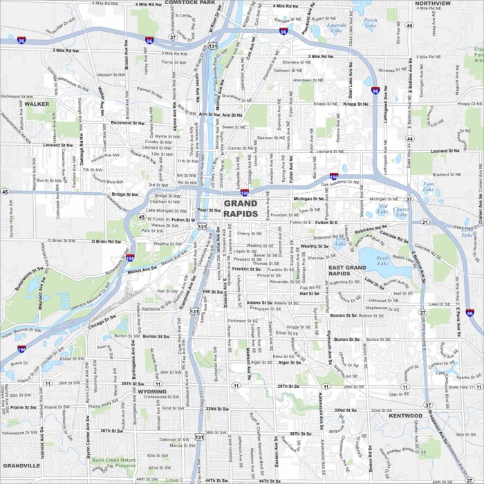
Our map of Grand Rapids follows the Grand River winding through downtown. Highways, parks, and neighborhoods stretch on both sides.
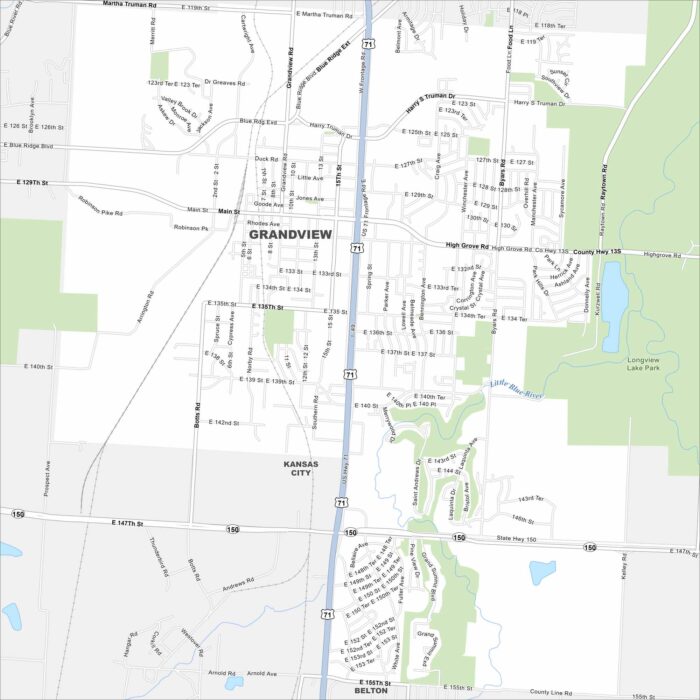
Grandview is a suburb just south of Kansas City. This map highlights its street grid, parks, and nearby highways.
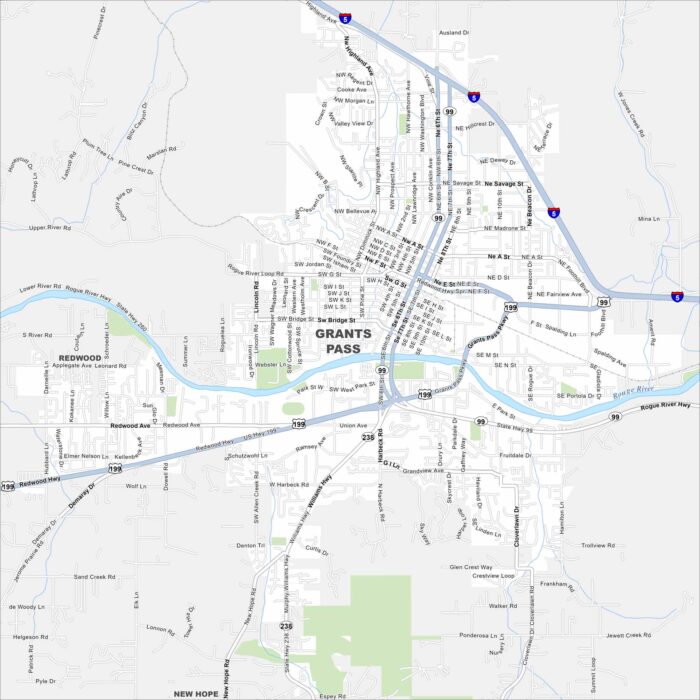
Take a look at Grants Pass, Oregon, along the Rogue River. Our map reveals interstates, roads, rivers and green spaces.