Map of Macon, Georgia
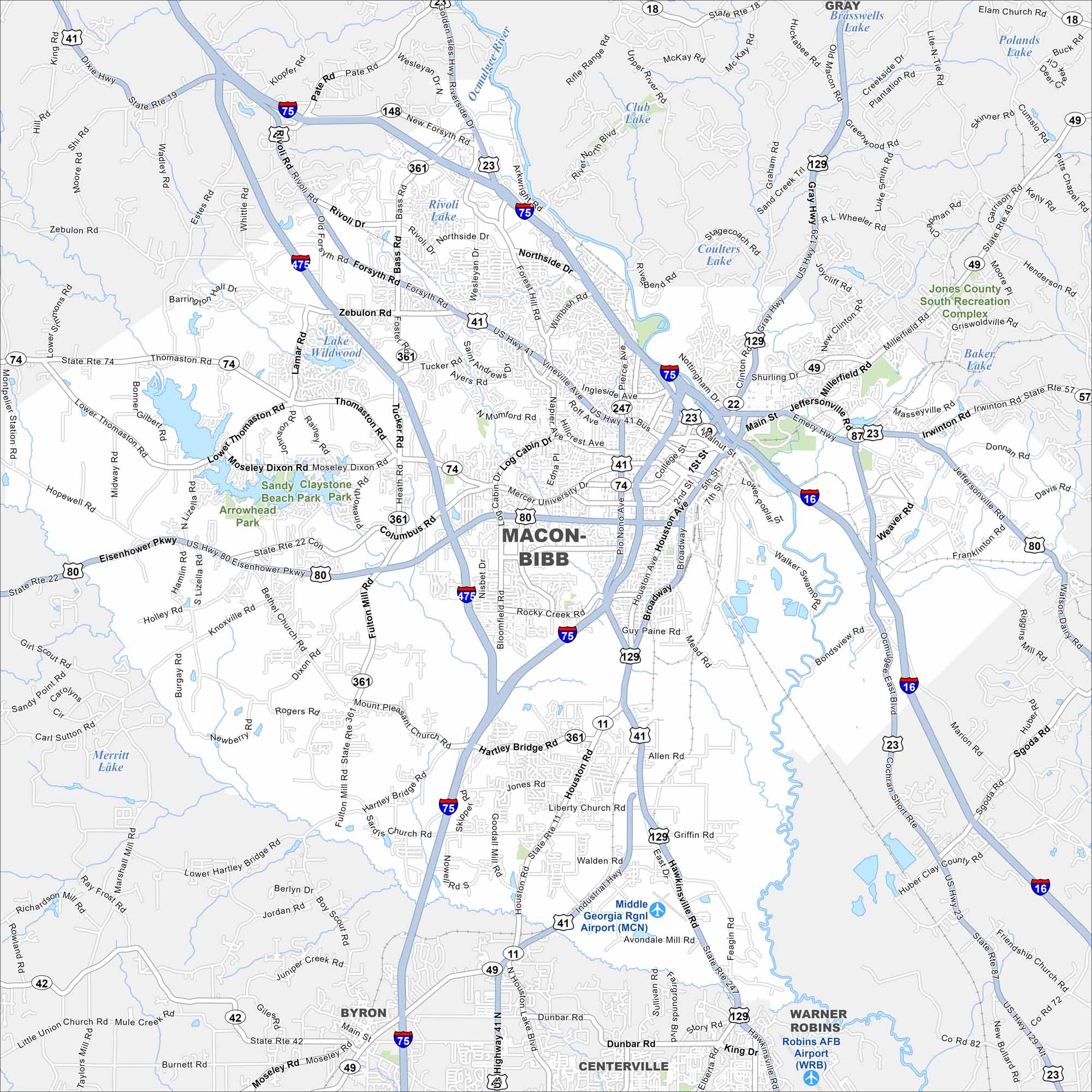
See Macon in central Georgia on our map. A key feature is the Ocmulgee River, which runs past downtown. Interstates 16 and 75 cross right through the city.
Georgia State Maps
Browse through our Georgia map collection


Map Information
On the Map
Interstates/Highways: I-75, I-475, I-16, US Hwy 41, US Hwy 80, US Hwy 129, US Hwy 23, State Rte 247, State Rte 74, State Rte 22, State Rte 11, State Rte 49 Major Roads: Eisenhower Pkwy, Houston Rd, Broadway, Main St, Pio Nono Ave, Zebulon Rd, Forsyth Rd, Vineville Ave, Jeffersonville Rd, Hartley Bridge Rd, Rocky Creek Rd, Mercer University Dr, Thomaston Rd, Shurling Dr, Millerfield Rd, Mumford Rd, Log Cabin Dr, Napier Ave, Anthony Rd, Guy Paine Rd Airports: Middle Georgia Rgnl Airport (MCN), Robins AFB Airport (WRB) Lakes and Reservoirs: Rivoli Lake, Lake Wildwood, Club Lake, Coulters Lake, Brasswells Lake, Polands Lake, Baker Lake, Merritt Lake Major Rivers: Ocmulgee River Parks and Preserves: Sandy Claystone Beach Park, Arrowhead Park Nearby Communities: Gray, Warner Robins, Centerville, ByronGeorgia City Maps
Get to know Atlanta and Georgia’s urban areas


