Longwood Gardens Map
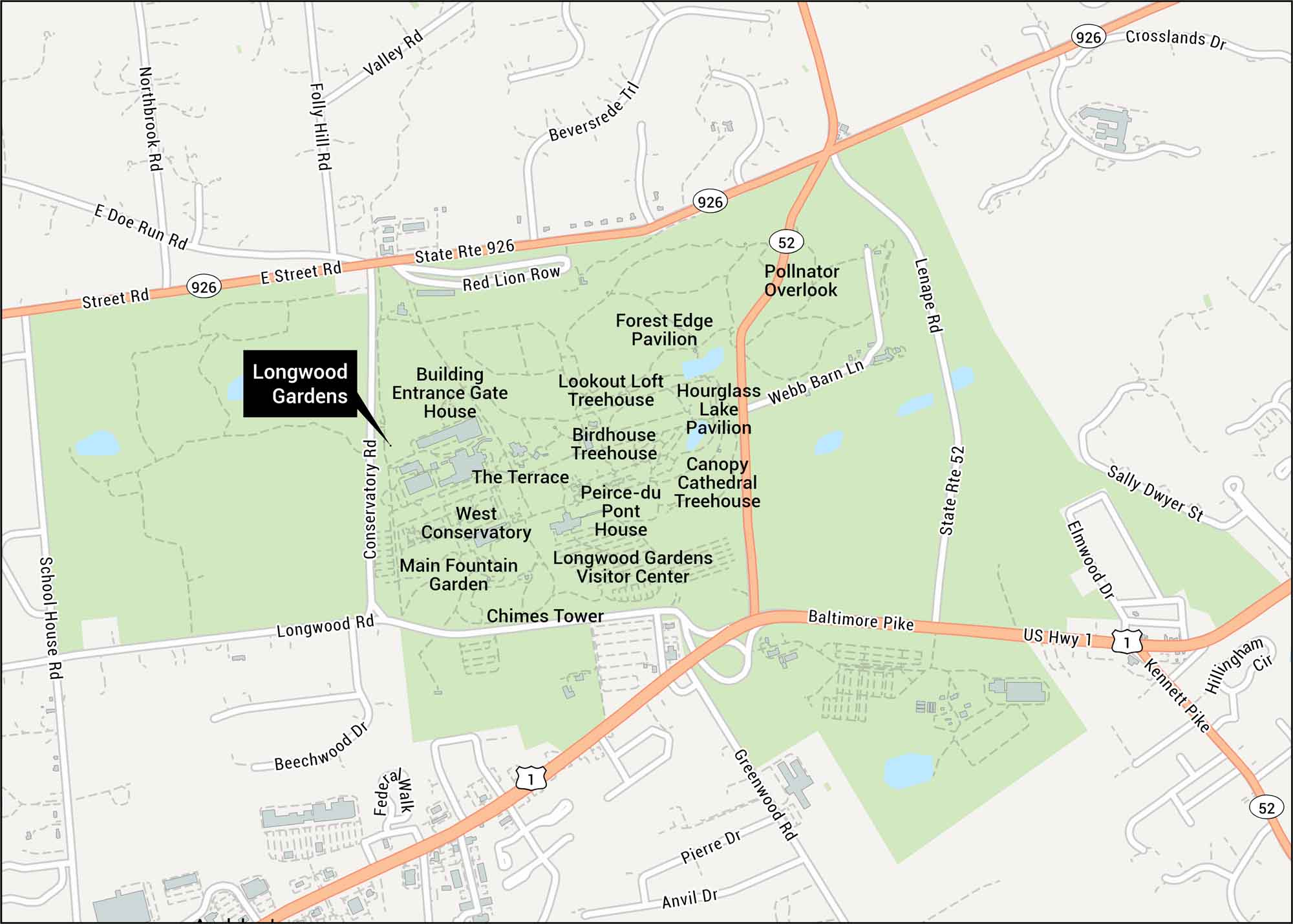
Start with this map of Longwood Gardens to follow paths, water features, and the main garden areas. Our map highlights ponds, trails, and the surrounding roads that lead to each entrance. The gardens sit in Pennsylvania’s Brandywine Valley, an area known for rolling hills and historic estates.
Map Information
On the Map
Interstates/Highways: US Hwy 1, State Rte 926, State Rte 52, Baltimore Pike Major Roads: Longwood Rd, Conservatory Rd, School House Rd, Street Rd, Doe Run Rd, Northbrook Rd, Folly Hill Rd, Valley Rd, Beversrede Trl, Red Lion Row, Webb Barn Ln, Lenape Rd, Greenwood Rd, Pierre Dr, Anvil Dr, Beechwood Dr, Kennett Pike Other Landmarks: Longwood Gardens Visitor Center, Main Fountain Garden, West Conservatory, Chimes Tower, Peirce-du Pont House, Building Entrance Gate House, The Terrace, Lookout Loft Treehouse, Birdhouse Treehouse, Canopy Cathedral Treehouse, Hourglass Lake Pavilion, Forest Edge Pavilion, Pollinator OverlookTourist Maps in Pennsylvania
Discover all the prime locations with our tourist maps.