Map of Lawrenceville, Georgia
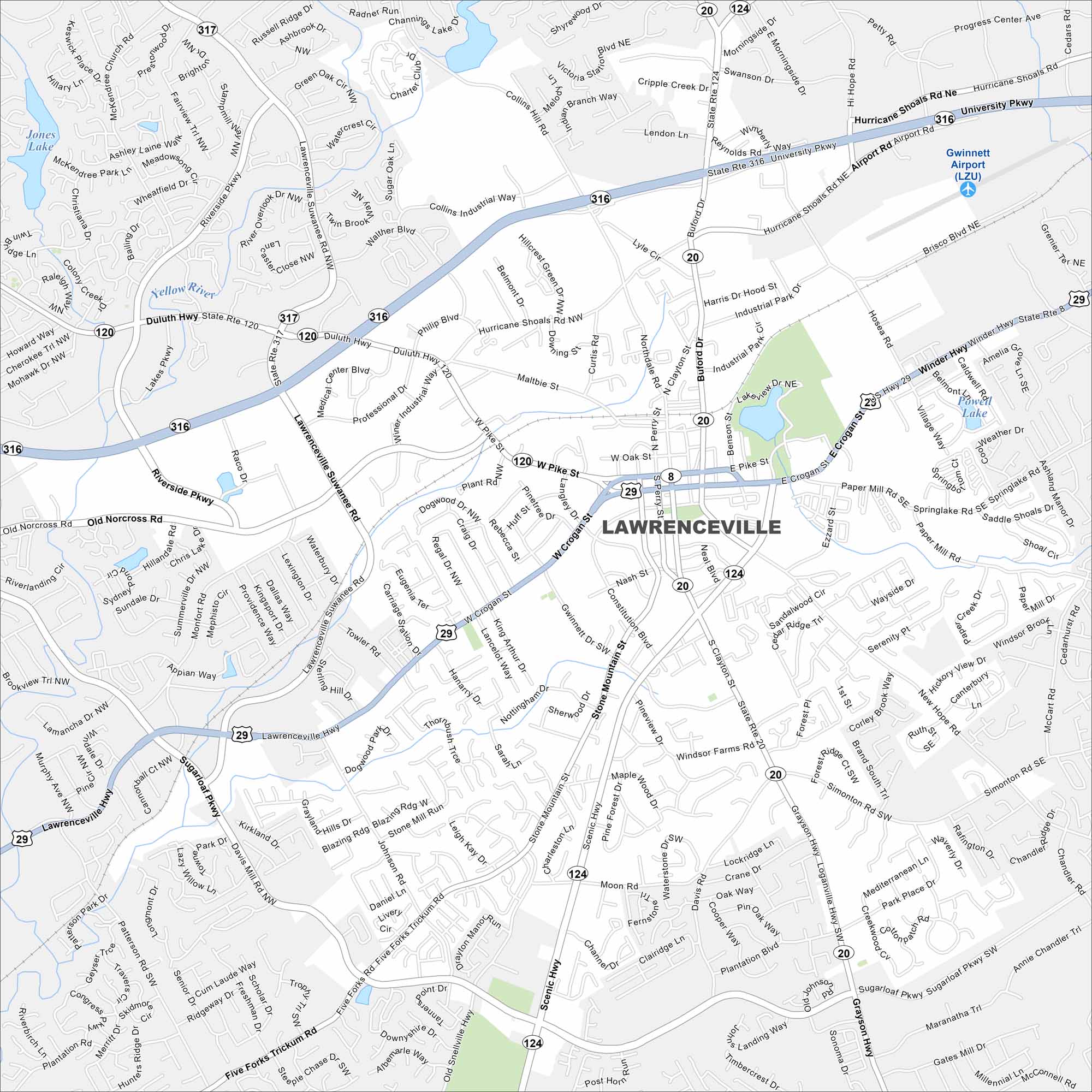
Explore Lawrenceville northeast of Atlanta, Georgia. The courthouse square anchors its center. New subdivisions fill the surrounding map.
Georgia State Maps
Browse through our Georgia map collection


Map Information
On the Map
Interstates/Highways: US Hwy 29, State Rte 316, State Rte 120, State Rte 20, State Rte 124, State Rte 317, State Rte 8, Duluth Hwy Major Roads: University Pkwy, Lawrenceville Suwanee Rd, Pike St, Crogan St, Grayson Hwy, Buford Dr, Riverside Pkwy, Five Forks Trickum Rd, Sugarloaf Pkwy, Hurricane Shoals Rd, Old Norcross Rd, Johnson Rd, Gwinnett Dr, Scenic Hwy, Simonton Rd, Paper Mill Rd, Collins Hill Rd, Hi Hope Rd, Moon Rd Airports: Gwinnett Airport (LZU) Lakes and Reservoirs: Jones Lake, Yellow River, Powell Lake Major Rivers: Yellow River Nearby Communities: SnellvilleGeorgia City Maps
Get to know Atlanta and Georgia’s urban areas


