Map of Kennesaw, Georgia
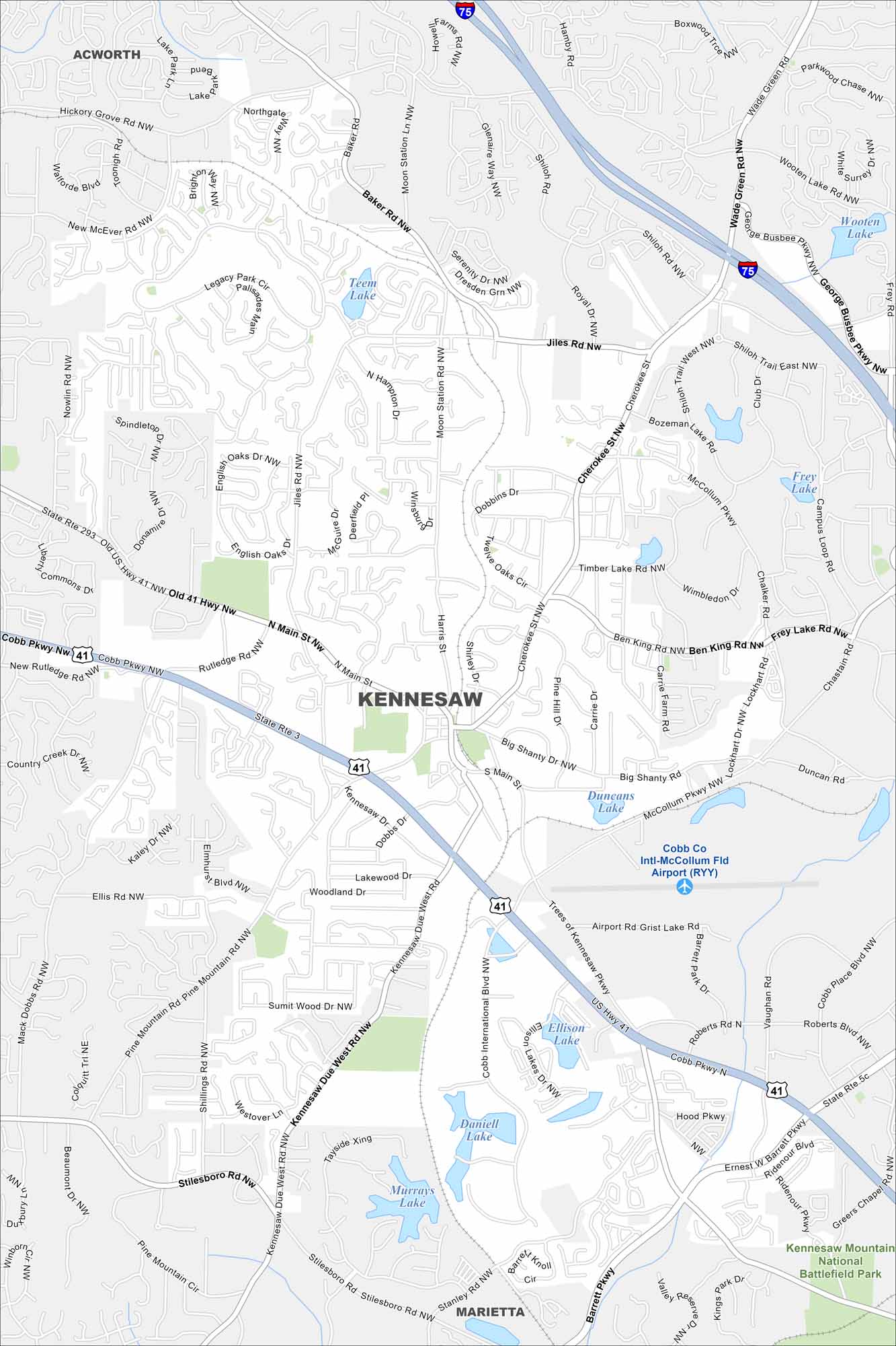
Kennesaw sits northwest of Atlanta. Our map shows Kennesaw Mountain National Battlefield Park on its edge with highways connecting it to the metro area.
Georgia State Maps
Browse through our Georgia map collection


Map Information
On the Map
Interstates/Highways: I-75, US Hwy 41, State Rte 293, State Rte 3 Major Roads: Cobb Pkwy, Main St, Wade Green Rd, Cherokee St, Shiloh Rd, Kennesaw Due West Rd, Pine Mountain Rd, Barrett Pkwy, Stilesboro Rd, Jiles Rd, Baker Rd, Moon Station Ln, George Busbee Pkwy, McCollum Pkwy, Big Shanty Rd, Roberts Rd, Ernest W Barrett Pkwy, Ridenour Blvd, Mack Dobbs Rd, Old 41 Hwy Lakes and Reservoirs: Teem Lake, Wooten Lake, Frey Lake, Bozeman Lake, Timber Lake, Duncans Lake, Ellison Lake, Daniell Lake, Murrays Lake Parks and Preserves: Kennesaw Mountain National Battlefield Park Nearby Communities: Acworth, MariettaGeorgia City Maps
Get to know Atlanta and Georgia’s urban areas


