Map of Harrisburg, Pennsylvania
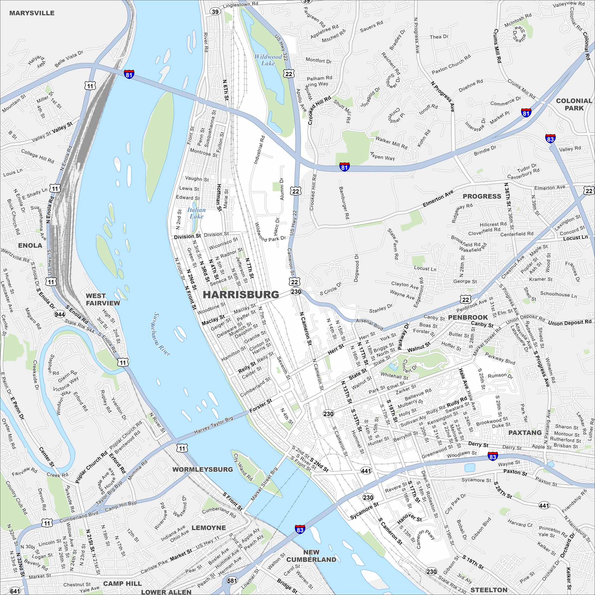
Harrisburg is along the Susquehanna River in south-central Pennsylvania. Our map shows its highways, roads, railways, lakes and rivers. The city is the state capital so it’s a key place in Pennsylvania.
Map Information
On the Map
Interstates/Highways: I-81, I-83, US Hwy 22, US Hwy 322, US Hwy 11, US Hwy 15, State Rte 230, State Rte 441, State Rte 581, State Rte 39 Major Roads: Front St, Cameron St, State St, Market St, Derry St, Maclay St, Division St, Walnut St, Forster St, Progress Ave, Paxton St, Elmerton Ave, Herr St, 2nd St, 3rd St, 7th St, 13th St, 17th St, 19th St, Sycamore St Lakes and Reservoirs: Wildwood Lake, Italian Lake Major Rivers: Susquehanna River Nearby Communities: Marysville, Enola, West Fairview, Wormleysburg, Lemoyne, Camp Hill, Lower Allen, New Cumberland, Steelton, Paxtang, Penbrook, Progress, Colonial ParkPennsylvania State Maps
Browse maps throughout the Keystone State.


City Maps of Pennsylvania
Here is our city map collection for all of Pennsylvania.


