Map of Eureka, California
Eureka sits on Humboldt Bay along the northern California coast. It borders both redwood forests and Pacific waters with a bayfront location.
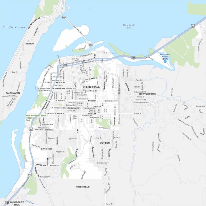
Eureka sits on Humboldt Bay along the northern California coast. It borders both redwood forests and Pacific waters with a bayfront location.
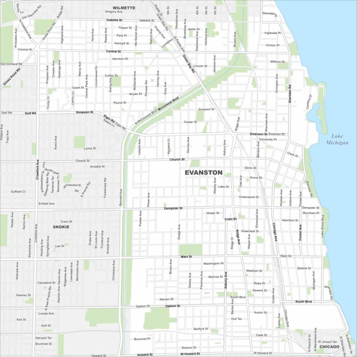
Evanston is on the Lake Michigan shoreline just north of Chicago. The road network runs straight into the lake. It also has a long waterfront.
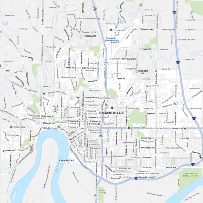
Our map of Evansville shows it curving along a bend in the Ohio River. Streets follow the river’s shape through downtown.
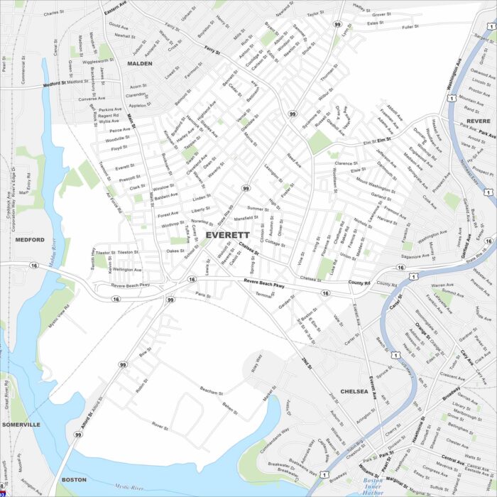
Everett is just north of Boston, bordered by the Mystic River and US Highway 1. Dense neighborhoods fill nearly every block.
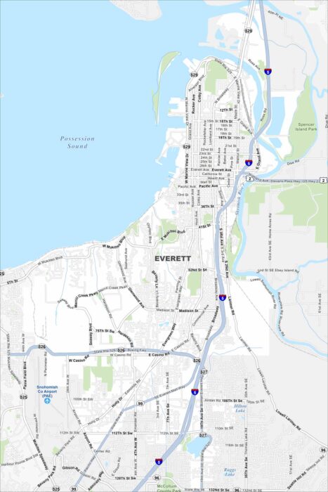
Explore our map of Everett on Puget Sound. The Snohomish River delta spreads out to the east. Its mix of water and coastline.
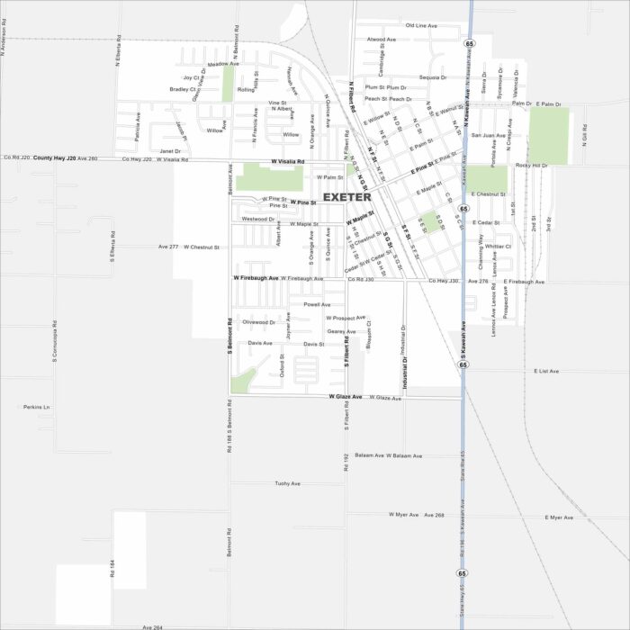
Exeter is in California’s Central Valley. The Sierra Nevada foothills rise not far away. Our map has its main routes, railways and parks.
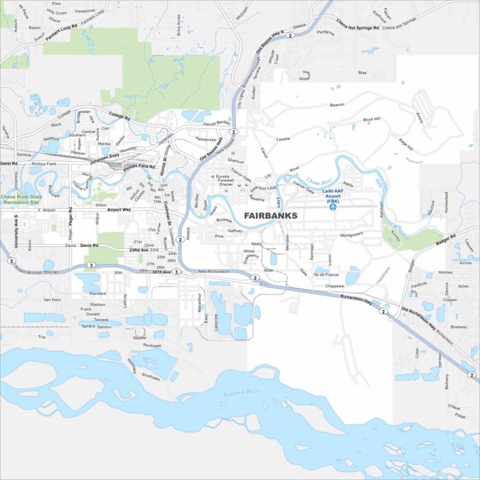
Fairbanks sits along the Chena River in interior Alaska. But the Tanana River flows just below it. Our map shows it surrounded by open land.
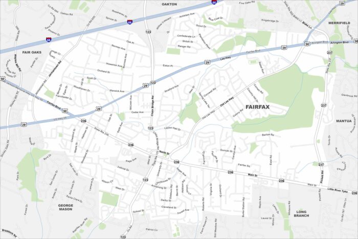
Our map of Fairfax places it west of Washington, D.C. Compact neighborhoods spread between highways like I-66 and Route 50.
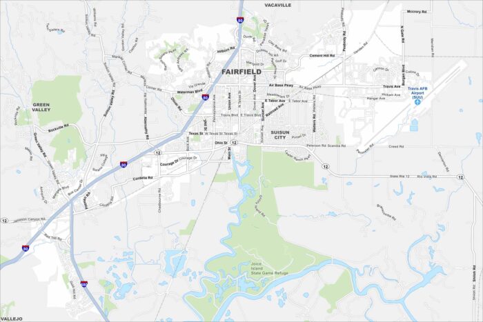
Fairfield lies between San Francisco and Sacramento in Solano County. This map shows highways, green spaces, and Travis Air Force Base.
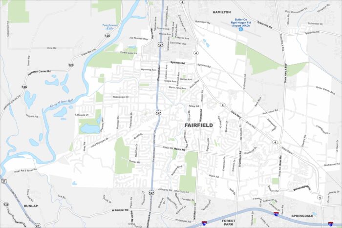
Fairfield is north of Cincinnati in southwest Ohio. The Great Miami River runs along its edge. That river gives the city its western boundary.
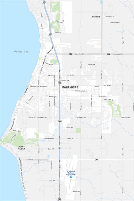
Check out our map of Fairhope on the eastern shore of Mobile Bay. Its streets slope gently toward the waterfront.
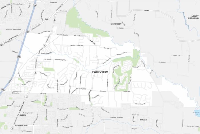
Fairview is a suburban town northeast of Dallas. Open land mixes with new developments along US-75. Our map shows its city and rural space.
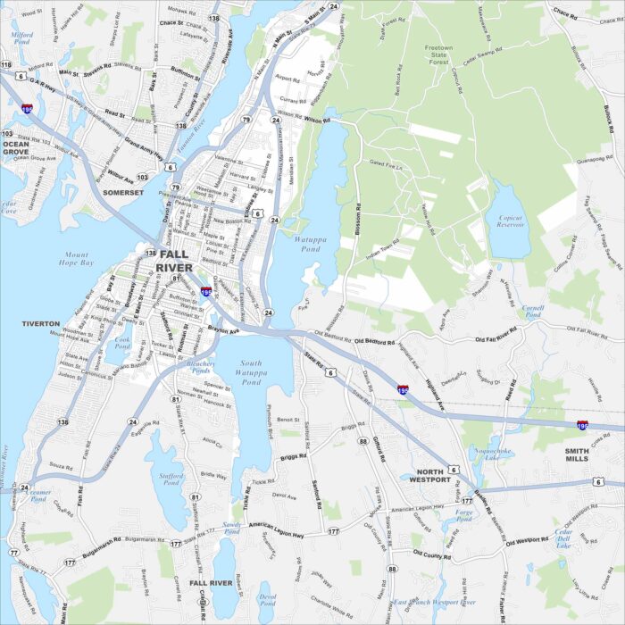
Fall River sits on Mount Hope Bay in southeastern Massachusetts. The Taunton River cuts through the city before reaching the bay.
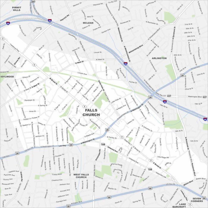
Our map of Falls Church shows it just outside Washington, D.C. Major routes like I-66 and Route 29 frame its edges.
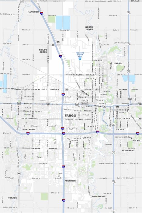
Fargo is on the Red River of the North, right on the Minnesota border. The map shows a flat, open landscape. Its position on the river is key.