Map of Carson, California
Carson is part of the Los Angeles area. Our map highlights its residential roads and nearby freeways. It has a central location.
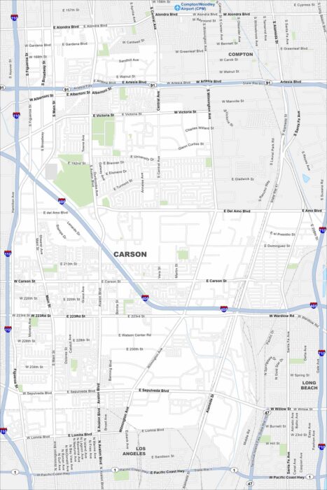
Carson is part of the Los Angeles area. Our map highlights its residential roads and nearby freeways. It has a central location.
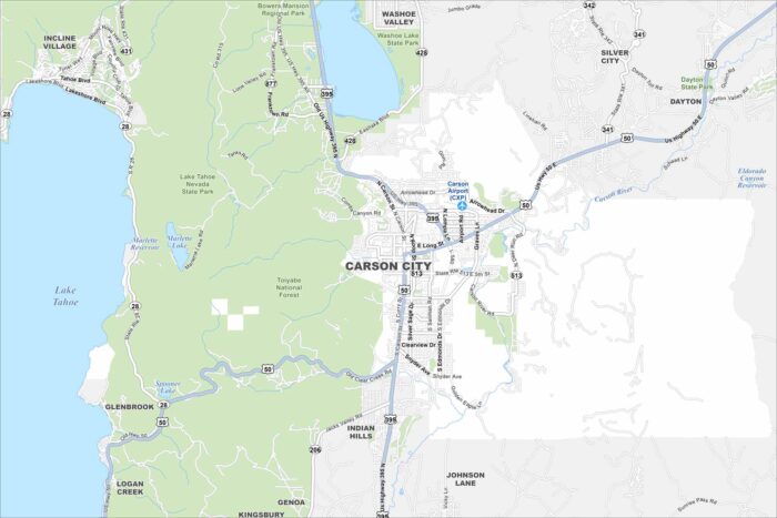
See Carson City on our map, showing the Carson River winding through the area. It’s the capital of Nevada.
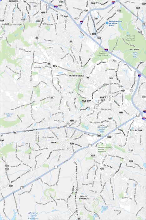
Cary, North Carolina is one of the fastest-growing cities in the Research Triangle. Our map shows lakes, parks, and neighborhoods.
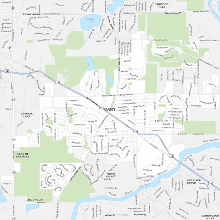
Explore Cary with our map, a village in northern Illinois. It sits along the Fox River with a mix of residential streets and green spaces.
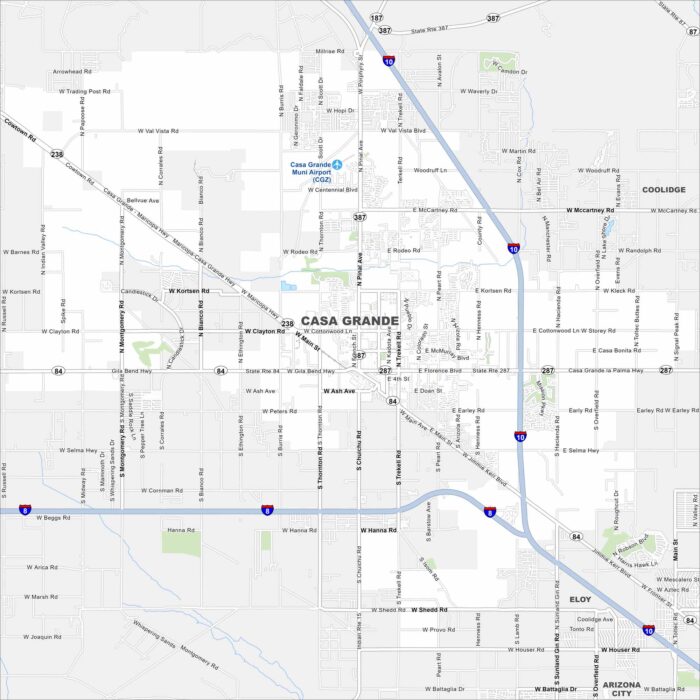
Our map of Casa Grande shows a desert city between Phoenix and Tucson. The city spreads across flat desert with mountain views.
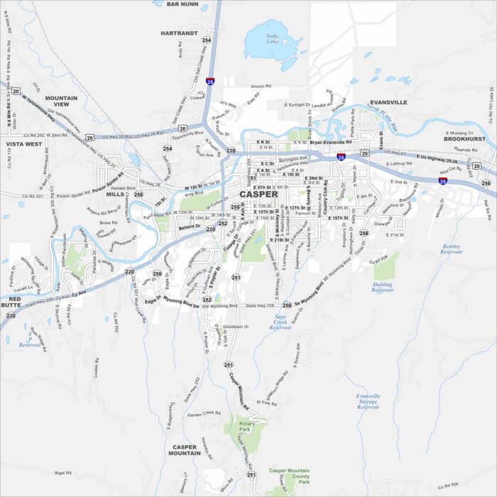
Casper is surrounded by wide plains and the North Platte River. Our map shows the city stretching at the foot of Casper Mountain.
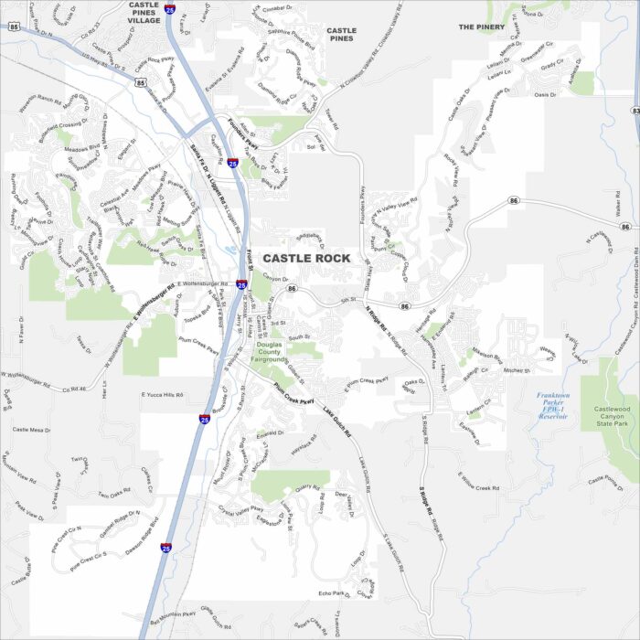
Explore Castle Rock with our map, set between Denver and Colorado Springs. The city is defined by its namesake butte and rolling hills.
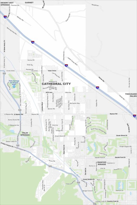
Our map of Cathedral City highlights desert streets and surrounding mountains. It sits in the Coachella Valley.
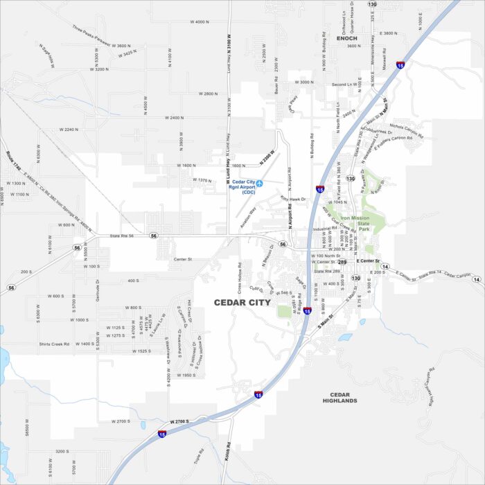
Cedar City is framed by mountains and high desert landscapes. Our map shows how it connects with nearby canyons and open land.
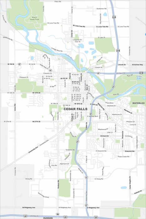
Take a look at Cedar Falls on our map. This is where the Cedar River flows through the city. Neighborhoods and parks line the riverbanks.
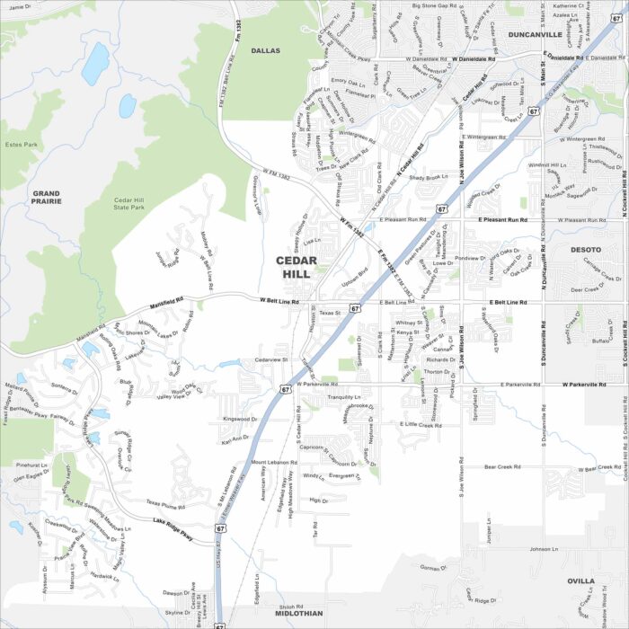
Here’s our map of Cedar Hill, Texas. The city sits in the Dallas-Fort Worth metroplex but keeps a more natural setting.
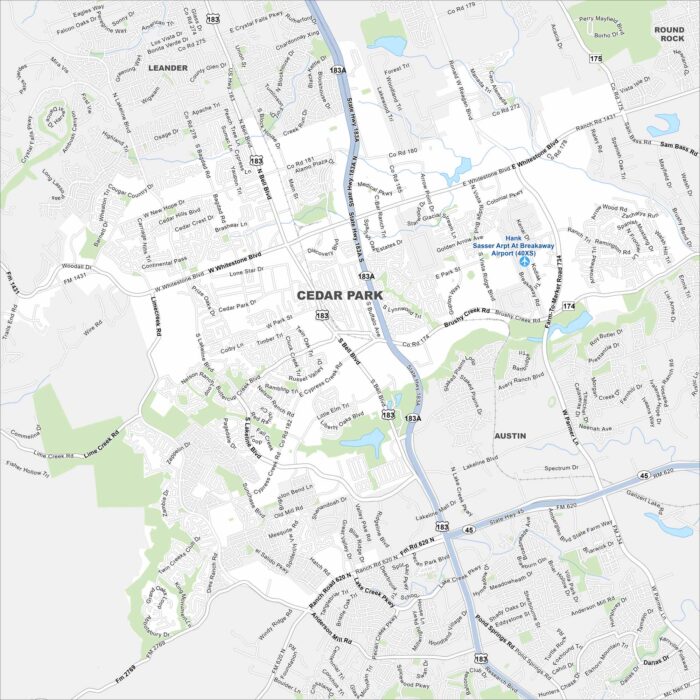
Cedar Park is a growing suburb just north of Austin. Our map highlights its neighborhoods, parks, and nearby highways.
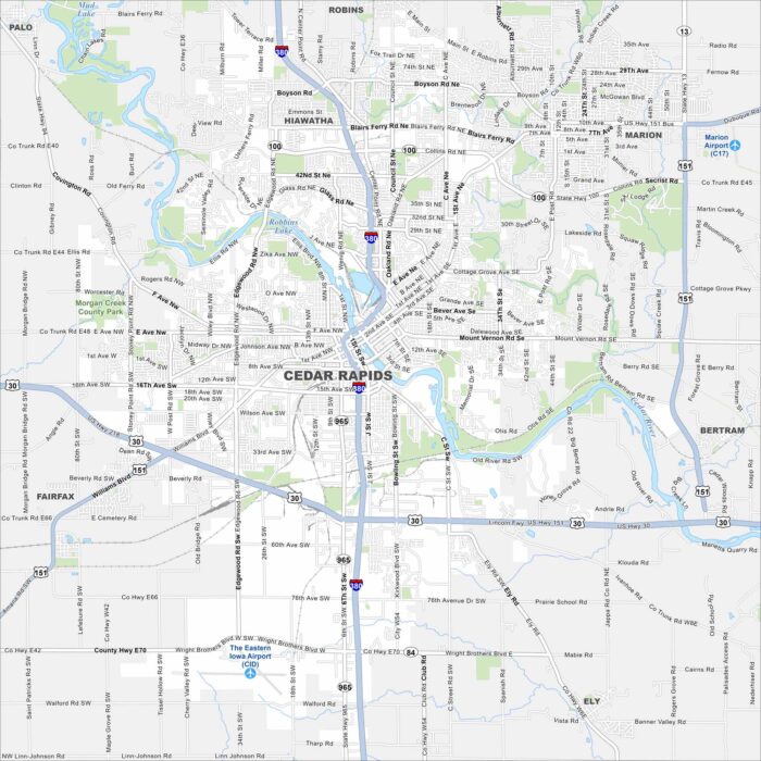
See Cedar Rapids on our map. Parks and neighborhoods stretch along the water, with Cedar River splitting the city in two.
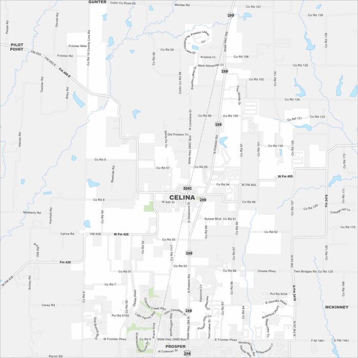
Our map of Celina shows a fast-growing city north of Dallas. Open land surrounds new neighborhoods and development.
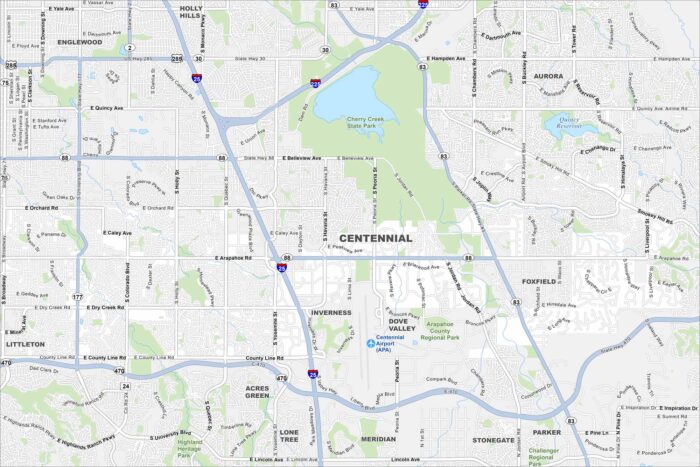
Centennial is a suburban city in the Denver metro. Our map highlights winding streets, open parks, and major roadways.