Map of Bethlehem, Pennsylvania
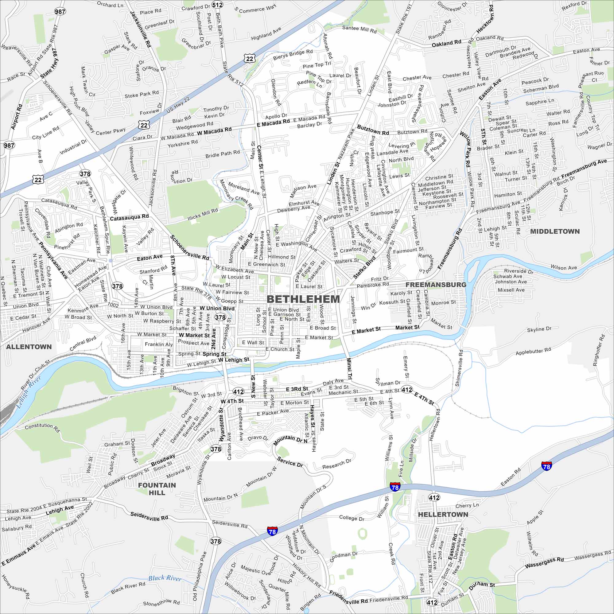
Our map of Bethlehem highlights the Lehigh River, bridges, and major highways. Neighborhood roads and green hills shape the layout. The city is often called “Christmas City” because of its Moravian roots.
Map Information
On the Map
Interstates/Highways: I-78, US Hwy 22, State Rte 512, State Rte 412, State Rte 378, State Rte 191 Major Roads: Easton Ave, Union Blvd, Broadway, Elizabeth Ave, Linden St, Main St, Stefko Blvd, Wyandotte St, Pembroke Rd, Hellertown Rd, Market St, Broad St, Center St, Macada Rd, Catasauqua Rd, Schoenersville Rd, Airport Rd, 8th Ave, 4th St, 3rd St Major Rivers: Lehigh River, Black River Nearby Communities: Allentown, Fullerton, Middletown, Freemansburg, Fountain Hill, HellertownPennsylvania State Maps
Browse maps throughout the Keystone State.


City Maps of Pennsylvania
Here is our city map collection for all of Pennsylvania.


