Map of Baldwin Borough, Pennsylvania
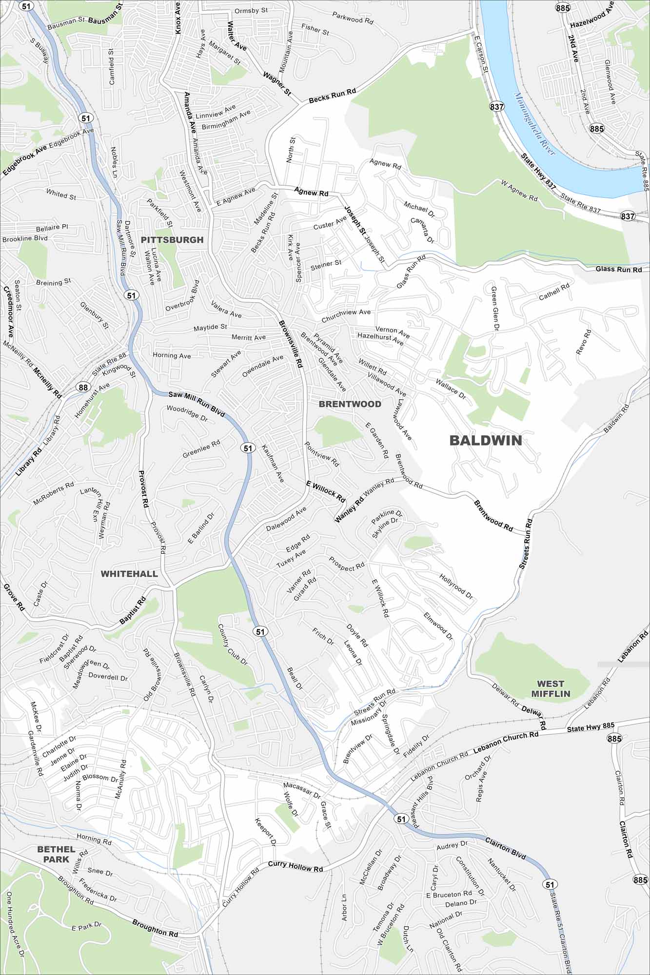
We’ve mapped Baldwin Borough with its streets, highways, and green spaces. The major highways here connect into Pittsburgh. It lies along the Monongahela River in Allegheny County.
Map Information
On the Map
Interstates/Highways: State Rte 51, State Rte 88, State Rte 837, State Rte 885 Major Roads: Clairton Blvd, Glass Run Rd, Streets Run Rd, Lebanon Church Rd, Becks Run Rd, Brownsville Rd, Curry Hollow Rd, Broughton Rd, McNeilly Rd, Library Rd, Agnew Rd, Brentwood Rd, Churchview Ave, Willock Rd, Baptist Rd, Provost Rd, Nobles Ln, Weyman Rd, Keeport Dr, Delwar Rd Major Rivers: Monongahela River Nearby Communities: Pittsburgh, Brentwood, Whitehall, West Mifflin, Bethel ParkPennsylvania State Maps
Browse maps throughout the Keystone State.


City Maps of Pennsylvania
Here is our city map collection for all of Pennsylvania.


