Map of Augusta, Georgia
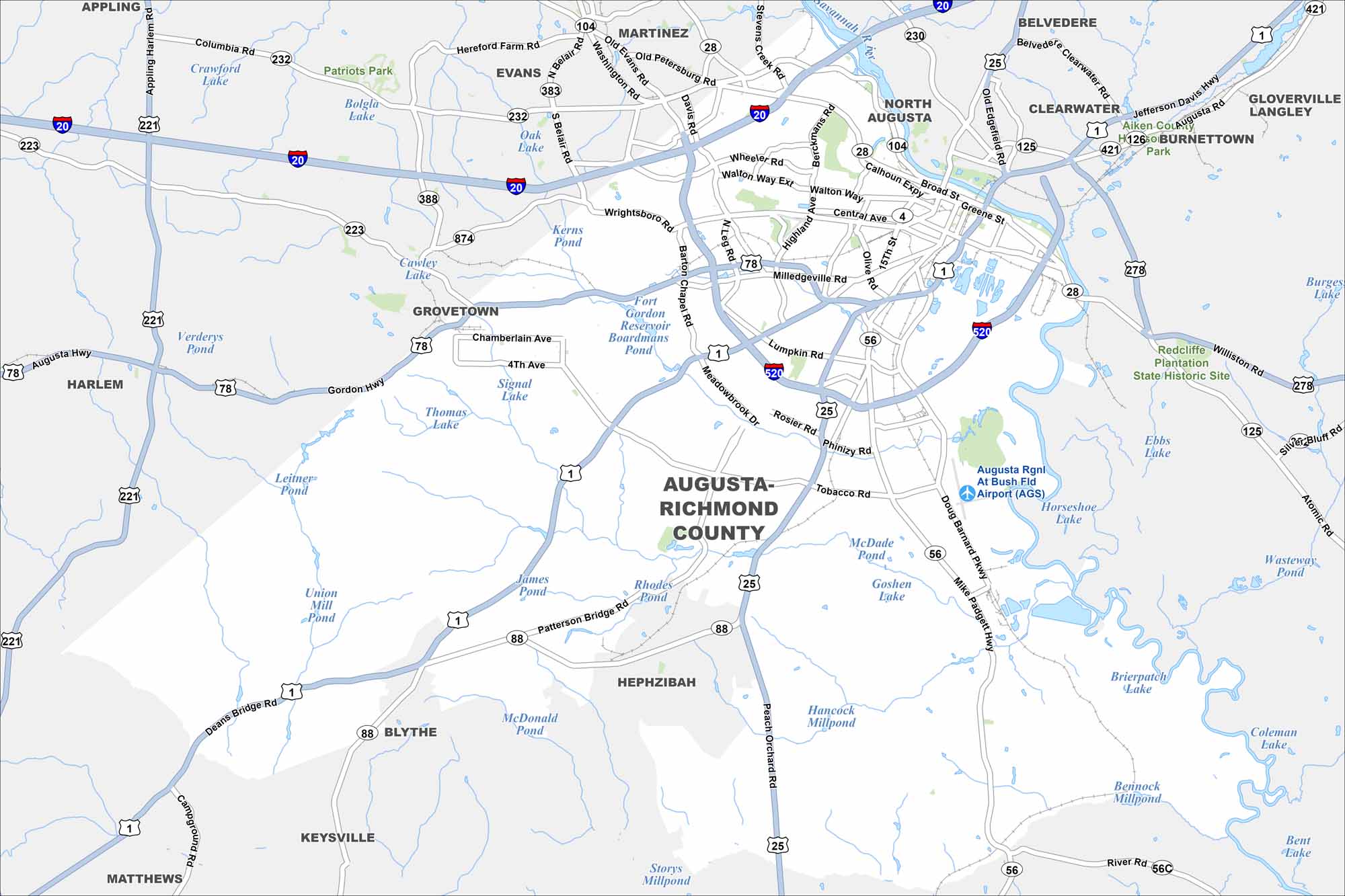
Augusta is mapped with its highways, streets, and rivers. The Savannah River flows right through the city. Augusta is world-famous for hosting the Masters golf tournament.
Georgia State Maps
Browse through our Georgia map collection


Map Information
On the Map
Interstates/Highways: I-20, I-520, US Hwy 1, US Hwy 25, US Hwy 78, State Rte 232, State Rte 383, State Rte 28, State Rte 104, State Rte 56, State Rte 88, State Rte 125, State Rte 421, Gordon Hwy, Bobby Jones Expy, Carl Sanders Hwy, Mike Padgett Hwy Major Roads: Wrightsboro Rd, Milledgeville Rd, Washington Rd, Broad St, Greene St, Walton Way, Peach Orchard Rd, Doug Barnard Pkwy, Tobacco Rd, Deans Bridge Rd, Belair Rd, Hereford Farm Rd, Old Petersburg Rd, Stevens Creek Rd, River Rd, Columbia Rd Airports: Augusta Rgnl At Bush Fld Airport (AGS) Lakes and Reservoirs: Fort Gordon Reservoir, Kerns Pond, Signal Lake, Thomas Lake, Rhodes Pond, Union Mill Pond, Leitner Pond, Verderys Pond, Crawford Lake, Bolgla Lake, Oak Lake, Mcade Pond, Goshen Lake, Horseshoe Lake, Ebbs Lake, Brierpatch Lake, Coleman Lake, Bennock Millpond, Hancock Millpond, Storys Millpond Major Rivers: Savannah River Parks and Preserves: Patriots Park, Redcliffe Plantation State Historic Site Nearby Communities: North Augusta, Martinez, Evans, Grovetown, Harlem, Hephzibah, Blythe, Keysville, Matthews, Belvedere, Clearwater, Burnettown, Gloverville, LangleyGeorgia City Maps
Get to know Atlanta and Georgia’s urban areas


