Map of Athens, Georgia
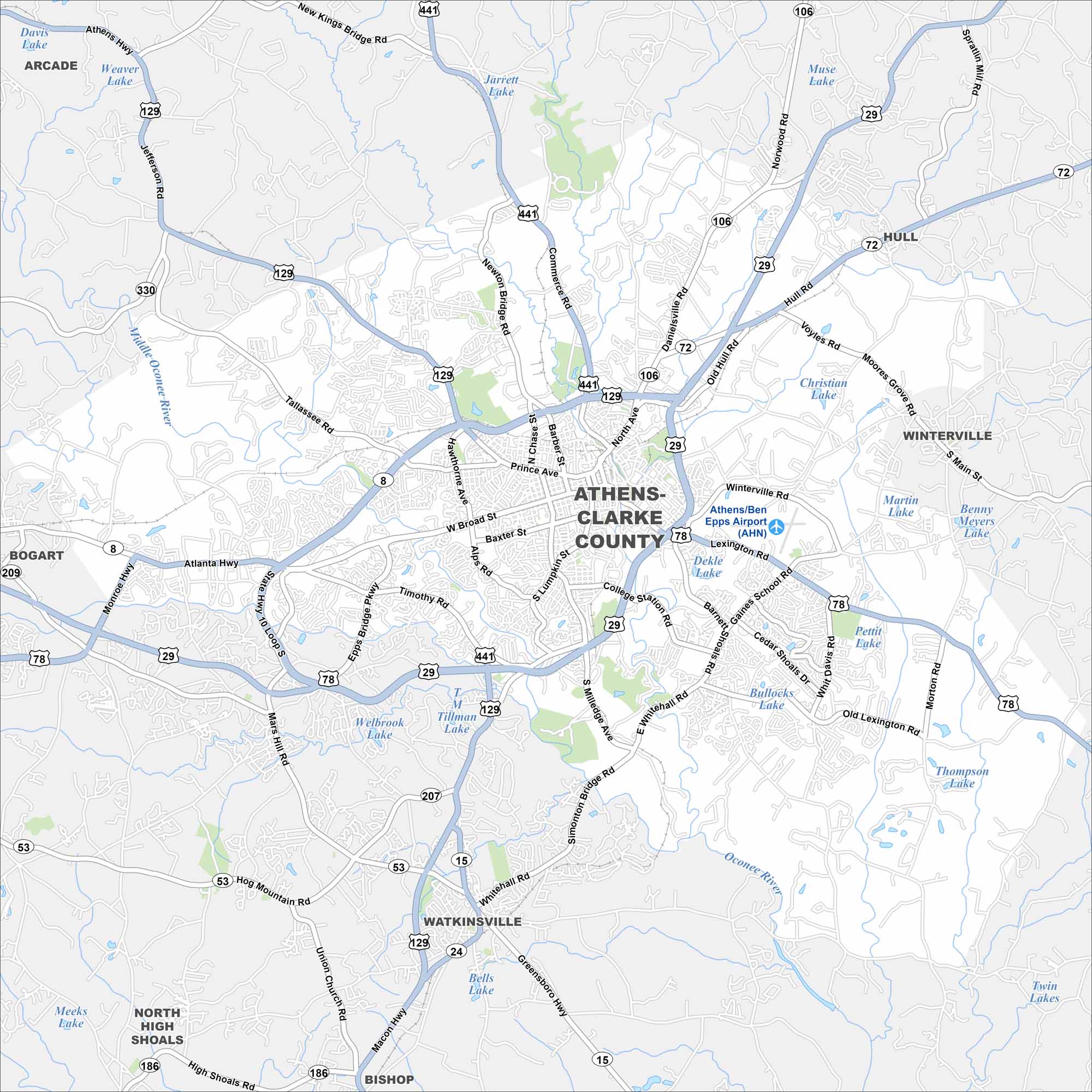
Get to know Athens, Georgia with our road map. It highlights the streets, highways, and parks. Roads wrap around the University of Georgia but it’s best known for its alternative rock music scene.
Georgia State Maps
Browse through our Georgia map collection


Map Information
On the Map
Interstates/Highways: US Hwy 129, US Hwy 441, US Hwy 29, US Hwy 78, State Rte 10 Loop, State Rte 15, State Rte 72, State Rte 8 Major Roads: Broad St, Milledge Ave, Lumpkin St, Baxter St, Prince Ave, Atlanta Hwy, Tallassee Rd, Jefferson Rd, Commerce Rd, Hull Rd, Winterville Rd, Lexington Rd, Gaines School Rd, Whitehall Rd, Barnett Shoals Rd, Watkinsville Rd, Macon Hwy, Mars Hill Rd, Epps Bridge Pkwy, Timothy Rd Airports: Athens/Ben Epps Airport (AHN) Lakes and Reservoirs: Jarrett Lake, Muse Lake, Christian Lake, Martin Lake, Dekle Lake, Pettit Lake, Thompson Lake, Twin Lakes, Bells Lake, Welbrook Lake, Tillman Lake, Meeks Lake, Davis Lake, Weaver Lake Major Rivers: Middle Oconee River Nearby Communities: Watkinsville, Winterville, Hull, Bogart, Bishop, Arcade, North High ShoalsGeorgia City Maps
Get to know Atlanta and Georgia’s urban areas


