Map of Alpharetta, Georgia
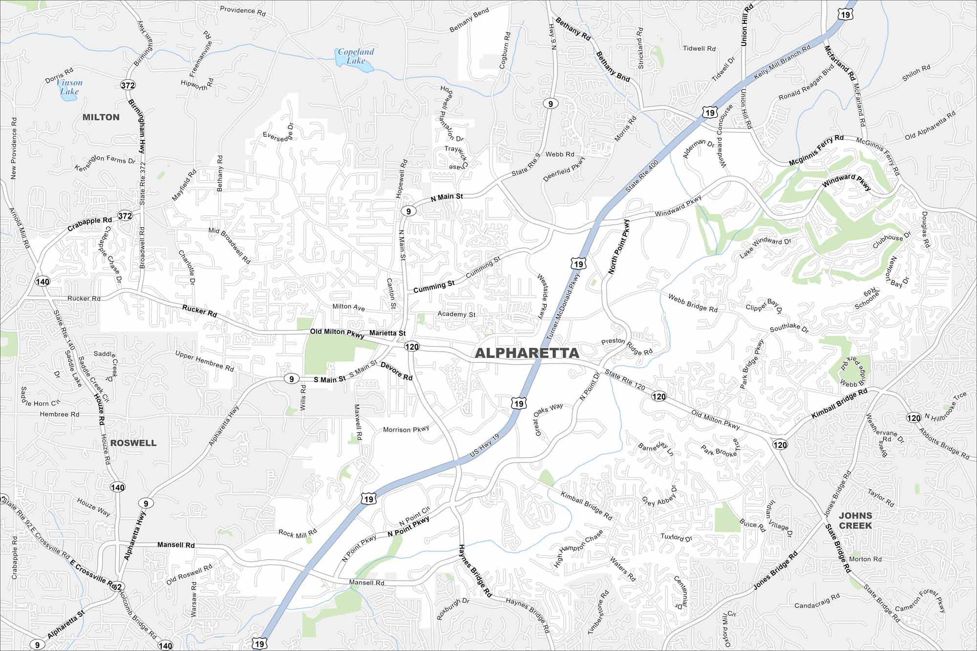
Here’s a fast-growing suburb north of Atlanta. Alpharetta has winding neighborhoods with major highways. It’s known for its tech hub and music venues. Use our map to show its highways and easy access to the North Georgia mountains.
Georgia State Maps
Browse through our Georgia map collection


Map Information
On the Map
Interstates/Highways: US Hwy 19, State Rte 400, State Rte 9, State Rte 120, State Rte 140, State Rte 372 Major Roads: Windward Pkwy, Mansell Rd, Old Milton Pkwy, Haynes Bridge Rd, North Point Pkwy, Kimball Bridge Rd, Webb Bridge Rd, Rucker Rd, Main St, Broadwell Rd, Mid Broadwell Rd, Alpharetta Hwy, Wills Rd, Houze Rd, Hembree Rd, Academy St, Westside Pkwy, McGinnis Ferry Rd, McFarland Rd, Union Hill Rd Lakes and Reservoirs: Copeland Lake, Vinson Lake Nearby Communities: Milton, Roswell, Johns CreekGeorgia City Maps
Get to know Atlanta and Georgia’s urban areas


