Map of Allentown, Pennsylvania
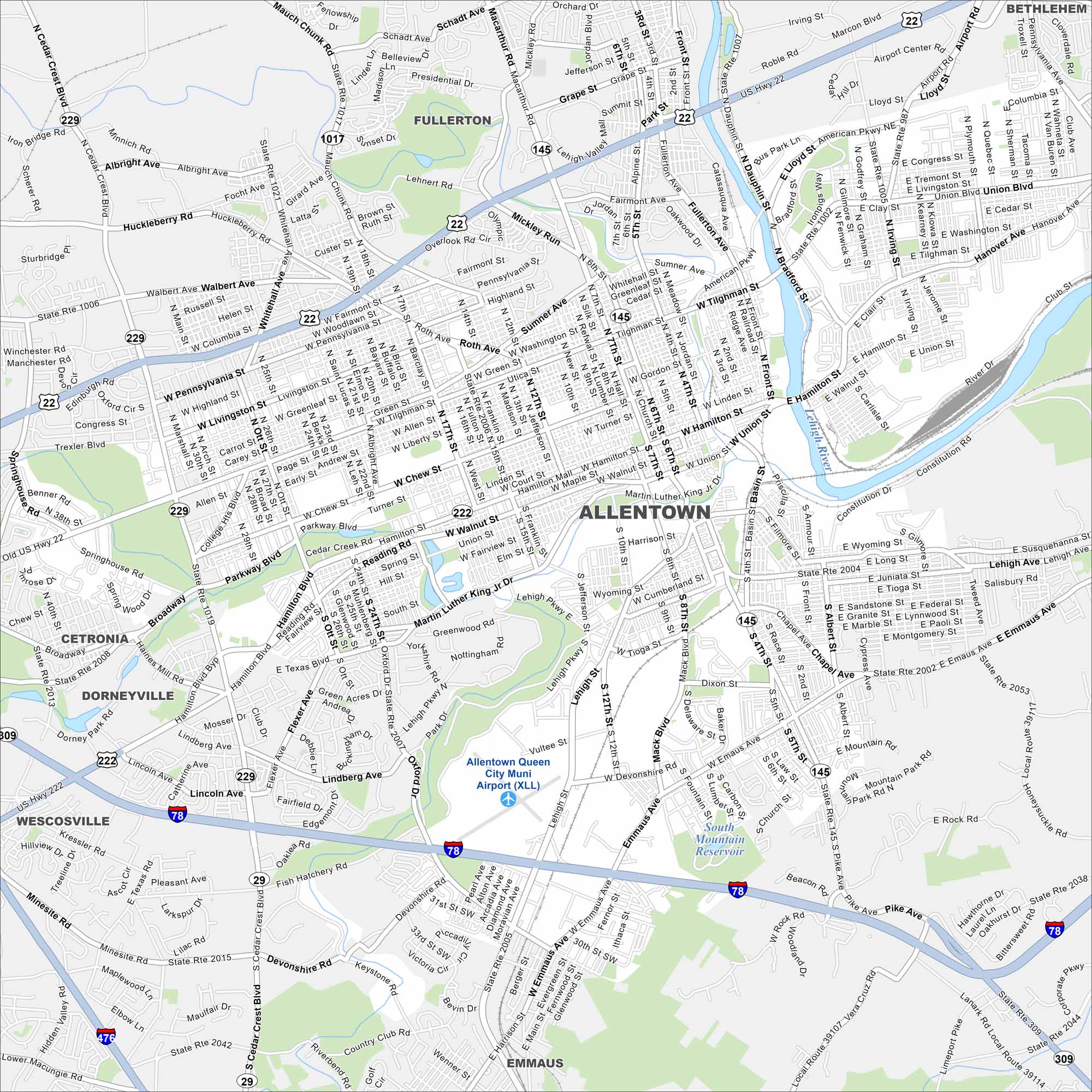
Our map of Allentown shows how the city stretches along the Lehigh River. Meanwhile, highways cut through old industrial corridors. It’s one of Pennsylvania’s largest cities, proud of its history and renewal.
Map Information
On the Map
Interstates/Highways: I-78, I-476, US Hwy 22, State Rte 1007, State Rte 145, State Rte 29, State Rte 229, State Rte 309 Major Roads: Hamilton Blvd, Union Blvd, Lehigh St, Tilghman St, Mauch Chunk Rd, American Pkwy, Airport Rd, Cedar Crest Blvd, Brookside Rd, Chew St, Walbert Ave, Emmaus Ave, Oxford Dr, 15th St, 7th St, 12th St, Martin Luther King Jr Dr, Fish Hatchery Rd, Devonshire Rd, Susquehanna St Airports: Allentown Queen City Muni Airport (XLL) Lakes and Reservoirs: South Mountain Reservoir Major Rivers: Lehigh River Nearby Communities: Fullerton, Bethlehem, Cetronia, Dorneyville, Wescosville, EmmausPennsylvania State Maps
Browse maps throughout the Keystone State.


City Maps of Pennsylvania
Here is our city map collection for all of Pennsylvania.


