Map of Altoona, Pennsylvania
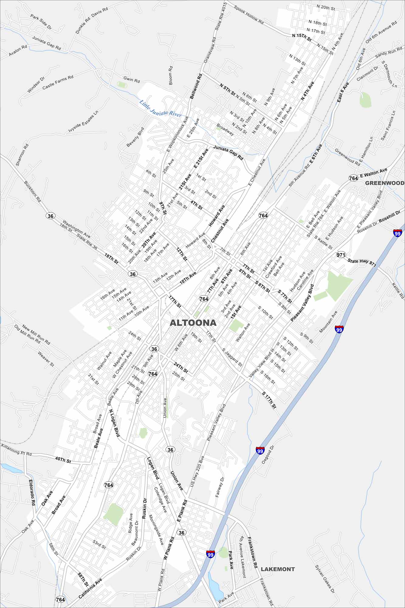
Built in the shadow of the railroad, Altoona spreads around the famous Horseshoe Curve. Streets wind through old neighborhoods on our map while highways cut through the Alleghenies.
Map Information
On the Map
Interstates/Highways: I-99, US Hwy 220 Bus, State Rte 4015, State Rte 764, State Rte 36, State Hwy 971 Major Roads: Pleasant Valley Blvd, Plank Rd, Logan Blvd, Chestnut Ave, Union Ave, Broad Ave, 6th Ave, 17th St, 7th St, 10th Ave, 58th St, Beale Ave, Walton Ave, Kettle Rd, 24th St, 10th St, California Ave, Frankstown Rd, 25th Ave, Howard Ave Major Rivers: Little Juniata River Nearby Communities: Greenwood, LakemontPennsylvania State Maps
Browse maps throughout the Keystone State.


City Maps of Pennsylvania
Here is our city map collection for all of Pennsylvania.


