Map of Warner Robins, Georgia
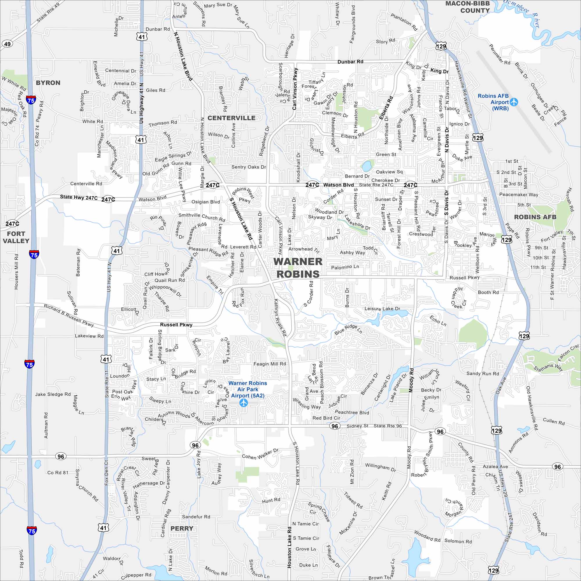
Our Warner Robins map helps you find the heart of Houston County. It’s known for Robins Air Force Base and strong community ties.
Georgia State Maps
Browse through our Georgia map collection


Map Information
On the Map
Interstates/Highways: I-75, US Hwy 41, US Hwy 129, State Rte 247, State Rte 247C, State Rte 11, State Rte 96 Major Roads: Watson Blvd, Russell Pkwy, Houston Lake Rd, Houston Rd, Moody Rd, Booth Rd, Lake Joy Rd, Feagin Mill Rd, Dunbar Rd, Davis Dr, Leverett Rd, Hatcher Rd, Elberta Rd, Green St, Collins Ave, Gunn Rd, Centerville Rd, Richard B Russell Pkwy, Carl Vinson Pkwy, Smith Pkwy Airports: Robins AFB Airport (WRB), Warner Robins Air Park Airport (5A2) Lakes and Reservoirs: Leisure Lake Major Rivers: Ocmulgee River Nearby Communities: Byron, Centerville, Fort Valley, Robins AFB, PerryGeorgia City Maps
Get to know Atlanta and Georgia’s urban areas


