Map of Brookhaven, Georgia
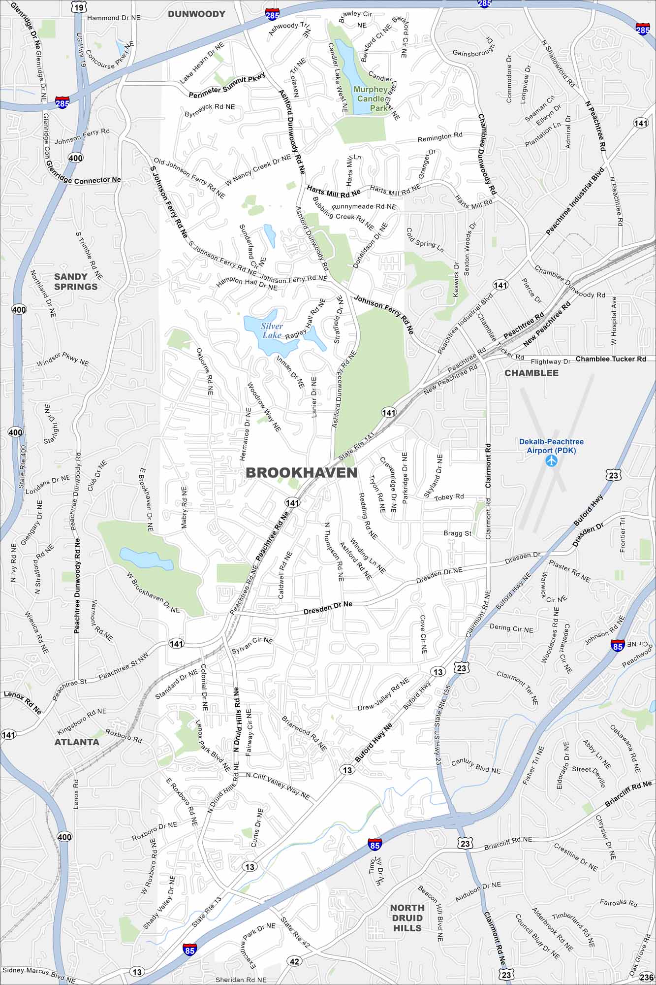
Explore our map of Brookhaven, which includes parks, waterways and highways. Major roads cut through making their way to Atlanta.
Georgia State Maps
Browse through our Georgia map collection


Map Information
On the Map
Interstates/Highways: I-285, I-85, US Hwy 19, State Rte 400, State Rte 141, State Rte 13, State Rte 23, State Rte 42, Buford Hwy Major Roads: Peachtree Rd, Clairmont Rd, North Druid Hills Rd, Johnson Ferry Rd, Ashford Dunwoody Rd, Chamblee Dunwoody Rd, Peachtree Industrial Blvd, Briarcliff Rd, Dresden Dr, Roxboro Rd, Lenox Rd, Nancy Creek Dr, Windsor Pkwy, Osborne Rd, Hermance Dr, Mabry Rd, Brookhaven Dr, Standard Dr, West Druid Hills Rd Airports: Dekalb-Peachtree Airport (PDK) Lakes and Reservoirs: Silver Lake Parks and Preserves: Murphey Candler Park Nearby Communities: Atlanta, Sandy Springs, Dunwoody, Chamblee, North Druid HillsGeorgia City Maps
Get to know Atlanta and Georgia’s urban areas


