Map of Douglasville, Georgia
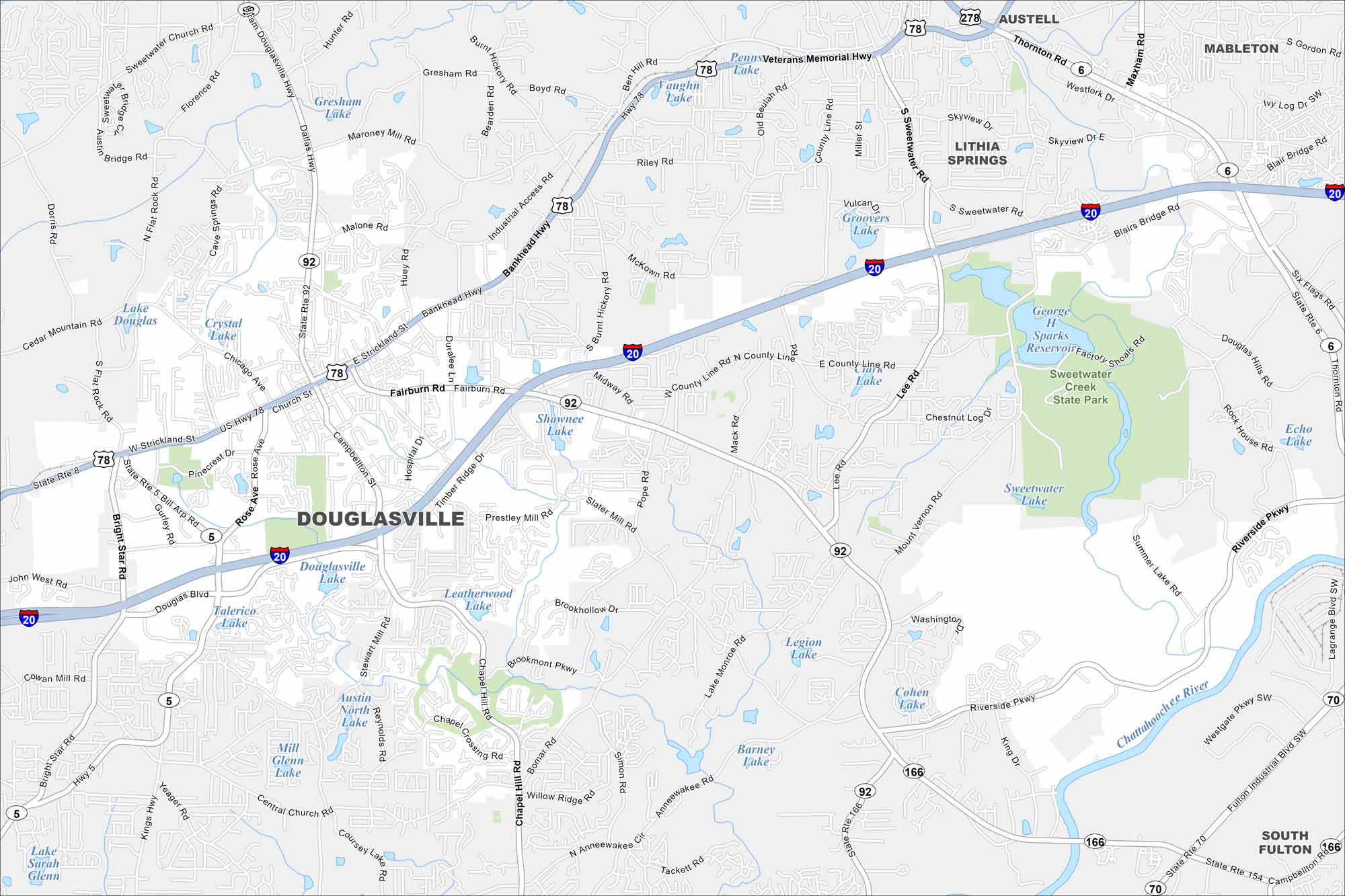
Our map of Douglasville shows a city west of Atlanta along I-20. Our map includes waterways, roadways and state parks. Its position makes it both a suburban community and a gateway to west Georgia.
Georgia State Maps
Browse through our Georgia map collection


Map Information
On the Map
Interstates/Highways: I-20, US Hwy 78, State Rte 92, State Rte 5, Bankhead Hwy, Dallas Hwy Major Roads: Fairburn Rd, Hospital Dr, Chapel Hill Rd, Stewart Mill Rd, Prestley Mill Rd, Bill Arp Rd, Midway Rd, Slater Mill Rd, Pope Rd, Mack Rd, Lee Rd, Mount Vernon Rd, Riverside Pkwy, Malone Rd, Huey Rd, Timber Ridge Dr, Campbellton St, Bright Star Rd Lakes and Reservoirs: Douglasville Lake, Shawnee Lake, Leatherwood Lake, North Austin Lake, Mill Glenn Lake, Coursey Lake, Lake Sarah Glenn, Lake Douglas, Crystal Lake, Vaughn Lake, Groovers Lake, Clark Lake, George H Sparks Reservoir, Echo Lake, Marchman Lake, Legion Lake, Cohen Lake, Barney Lake, Lake Louise Major Rivers: Chattahoochee River Parks and Preserves: Sweetwater Creek State Park Nearby Communities: Lithia Springs, Austell, Mableton, South FultonGeorgia City Maps
Get to know Atlanta and Georgia’s urban areas


