Map of Erie, Pennsylvania
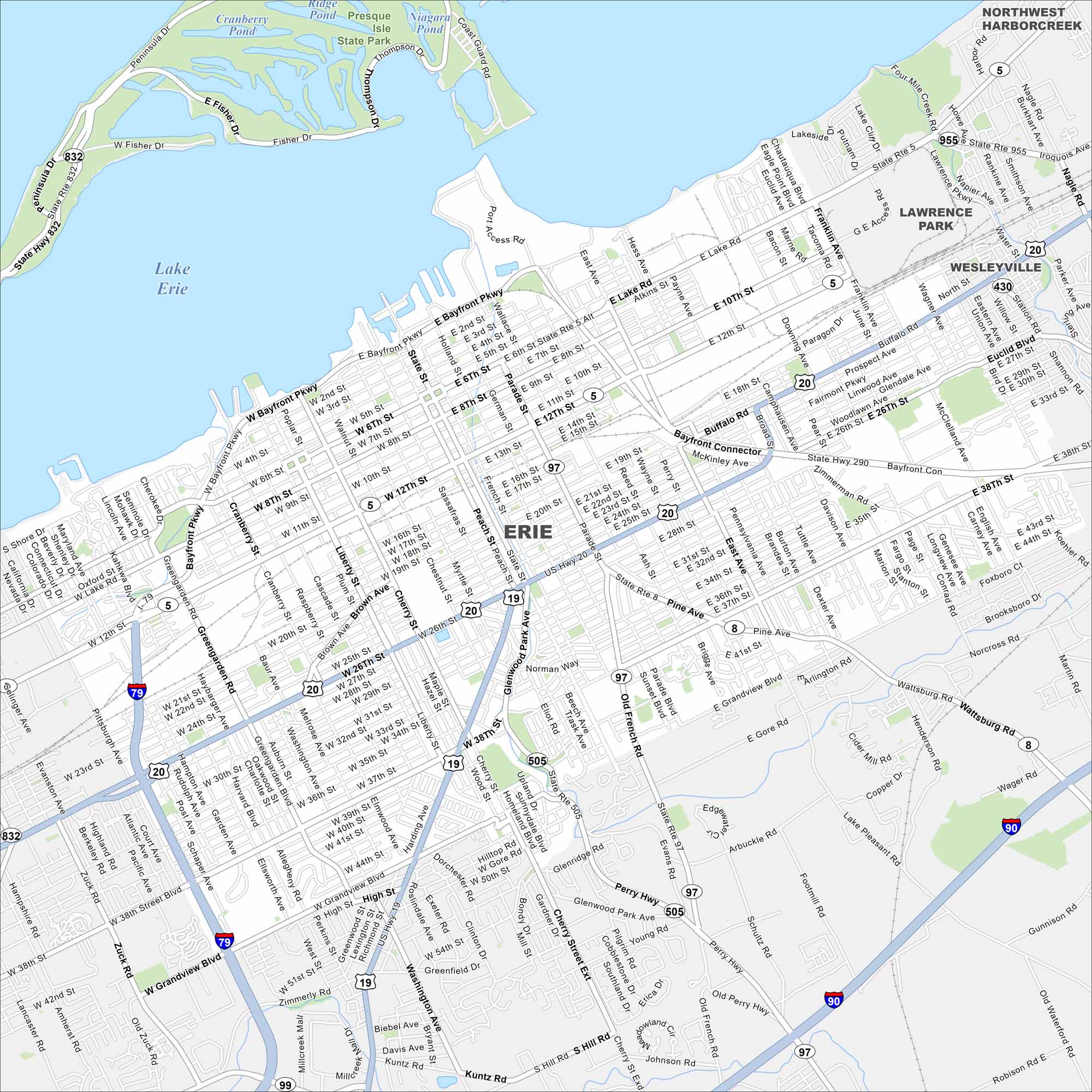
Erie lies on the southern shore of Lake Erie. Its downtown runs right up to Presque Isle Bay. The peninsula sheltering the bay is the city’s landmark.
Map Information
On the Map
Interstates/Highways: I-79, I-90, US Hwy 20, State Rte 5, State Rte 5 Alt, State Rte 290, State Rte 8, State Rte 97, State Rte 505, State Rte 832, State Rte 955, State Rte 430 Major Roads: Bayfront Pkwy, State St, Buffalo Rd, Peach St, 12th St, 26th St, 38th St, Grandview Blvd, Glenwood Park Ave, Liberty St, Sassafras St, Holland St, French St, Parade St, Wayne St, East Lake Rd, West Lake Rd, Greengarden Rd, Pittsburgh Ave, Zuck Rd Airports: Erie Intl Airport Lakes and Reservoirs: Lake Erie, Cranberry Pond, Ridge Pond, Misery Bay, Horseshoe Pond, Niagara Pond, Graveyard Pond Parks and Preserves: Presque Isle State Park Nearby Communities: Lawrence Park, Wesleyville, Northwest HarborcreekPennsylvania State Maps
Browse maps throughout the Keystone State.


City Maps of Pennsylvania
Here is our city map collection for all of Pennsylvania.


