Map of Forest Park, Georgia
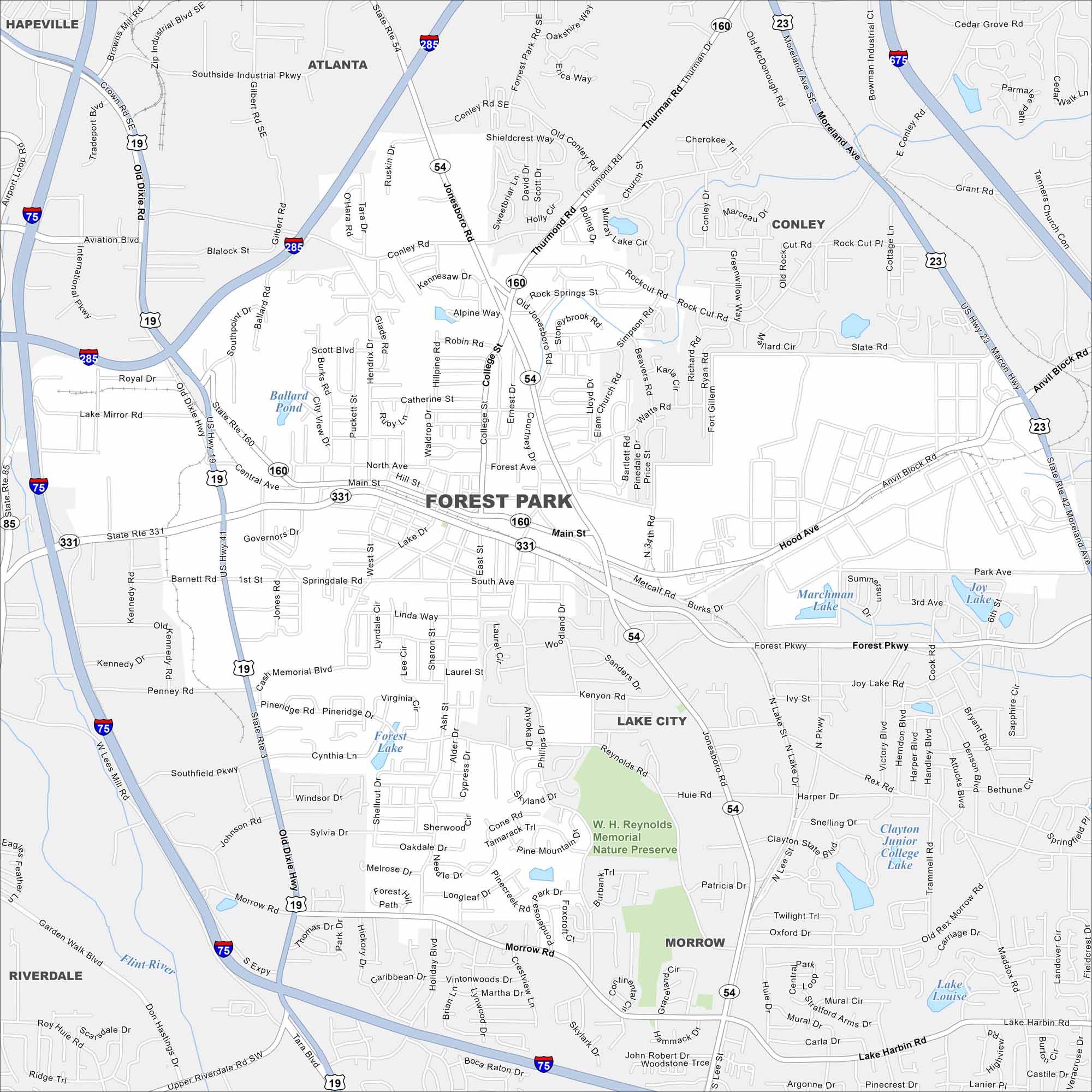
Our map of Forest Park shows it just south of Atlanta. Residential blocks mix with industrial space nearby. But the city still holds a strong character true to its name.
Georgia State Maps
Browse through our Georgia map collection


Map Information
On the Map
Interstates/Highways: I-75, I-285, I-675, US Hwy 41, State Rte 54, State Rte 160, State Rte 331, State Rte 85 Major Roads: Forest Pkwy, Jonesboro Rd, Main St, Old Dixie Hwy, Central Ave, Moreland Ave, Conley Rd, Thurmond Rd, Rock Springs Rd, Anvil Block Rd, Morrow Rd, Lake City Industrial Blvd, Southside Industrial Pkwy, Aviation Blvd, Governors Dr, Pineridge Rd, Reynolds Rd, Phillips Dr, Cypress Dr, Ash St Lakes and Reservoirs: Lake Dr, Forest Lake, Marchman Lake, Joy Lake, Clayton Junior College Lake, Lake Louise, Lake Harbin Major Rivers: Flint River Parks and Preserves: W. H. Reynolds Memorial Nature Preserve Nearby Communities: Atlanta, Hapeville, Conley, Lake City, Morrow, RiverdaleGeorgia City Maps
Get to know Atlanta and Georgia’s urban areas


