Map of Gainesville, Georgia
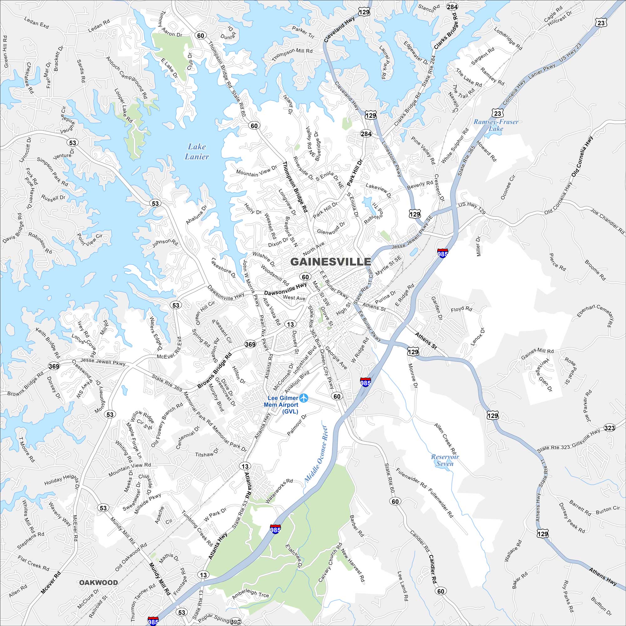
Our map of Gainesville highlights its spot on Lake Lanier. The shoreline with coves and marinas is a major feature. Highways lead out toward the foothills of the Blue Ridge.
Georgia State Maps
Browse through our Georgia map collection


Map Information
On the Map
Interstates/Highways: I-985, US Hwy 129, US Hwy 23, State Rte 60, State Rte 53, State Rte 13, State Rte 369, State Rte 284, State Rte 323, Dawsonville Hwy Major Roads: Thompson Bridge Rd, Jesse Jewell Pkwy, Browns Bridge Rd, Athens Hwy, McEver Rd, Mundy Mill Rd, Queen City Pkwy, Atlanta Hwy, Limestone Pkwy, Park Hill Dr, E.E. Butler Pkwy, Main St, Pearl Nix Pkwy, Aviation Blvd, Memorial Park Rd, Old Flower Mill Rd, Poplar Springs Rd, Cleveland Hwy, Cornelia Hwy Lakes and Reservoirs: Lake Lanier, Reservoir Seven Major Rivers: Middle Oconee River Nearby Communities: OakwoodGeorgia City Maps
Get to know Atlanta and Georgia’s urban areas


