Map of Johns Creek, Georgia
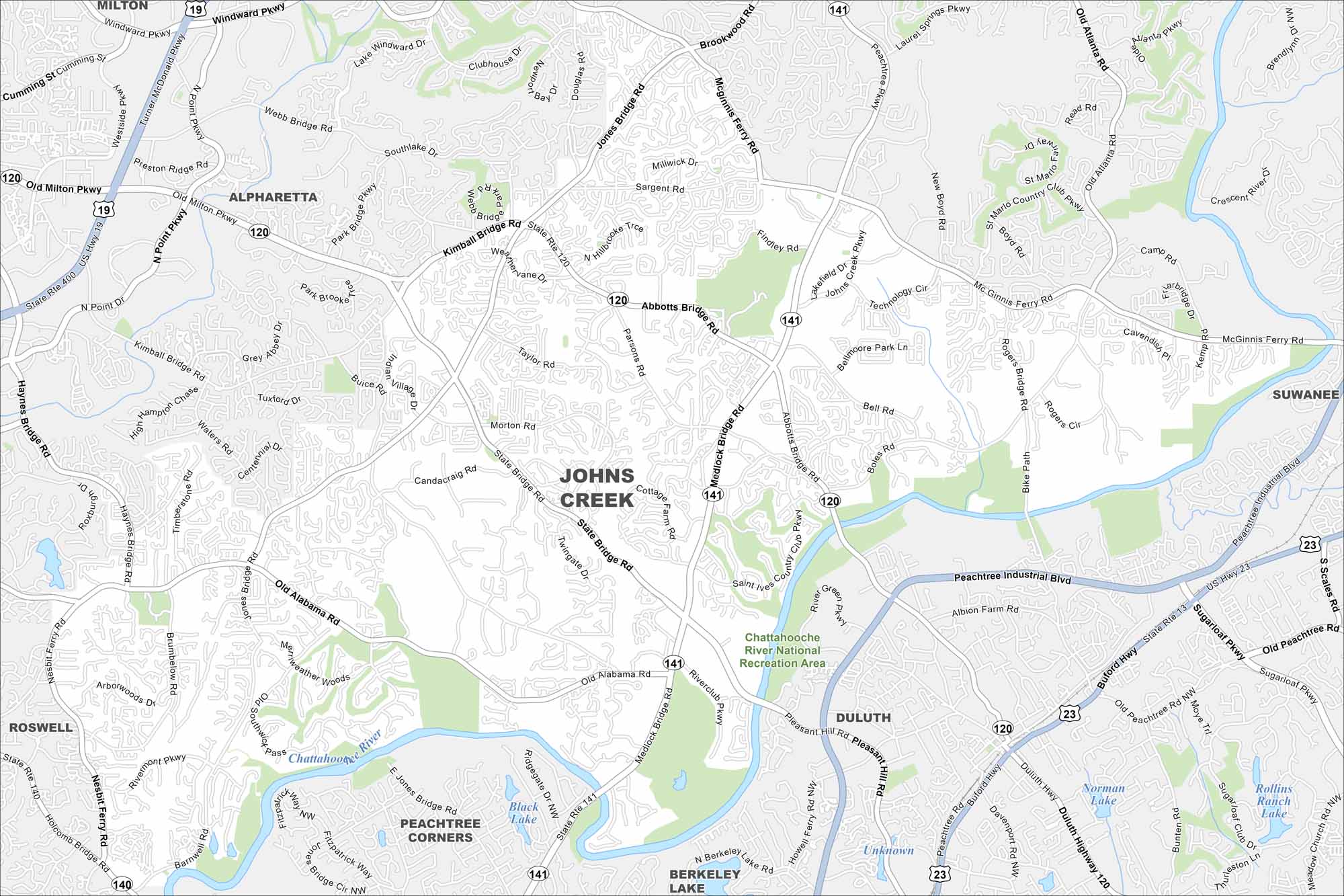
Johns Creek lies northeast of Atlanta with lots of parks and golf courses. Our map shows residential development broken up by the Chattahoochee River.
Georgia State Maps
Browse through our Georgia map collection


Map Information
On the Map
Interstates/Highways: US Hwy 19, US Hwy 23, State Rte 141, State Rte 120 Major Roads: Peachtree Industrial Blvd, Medlock Bridge Rd, State Bridge Rd, Abbotts Bridge Rd, McGinnis Ferry Rd, Old Alabama Rd, Jones Bridge Rd, Buford Hwy, Peachtree Pkwy, Barnwell Rd, Buice Rd, Sargent Rd, Webb Bridge Rd, Kimball Bridge Rd, North Point Pkwy, Old Milton Pkwy, Nesbit Ferry Rd, Riverclub Pkwy, Brumbelow Rd, Findley Rd Airports: Lakes and Reservoirs: Black Lake, Norman Lake, Rollins Ranch Lake Major Rivers: Chattahoochee River Parks and Preserves: Chattahoochee River National Recreation Area Nearby Communities: Milton, Alpharetta, Suwanee, Duluth, Peachtree Corners, Berkeley Lake, RoswellGeorgia City Maps
Get to know Atlanta and Georgia’s urban areas


