Map of Williamsport, Pennsylvania
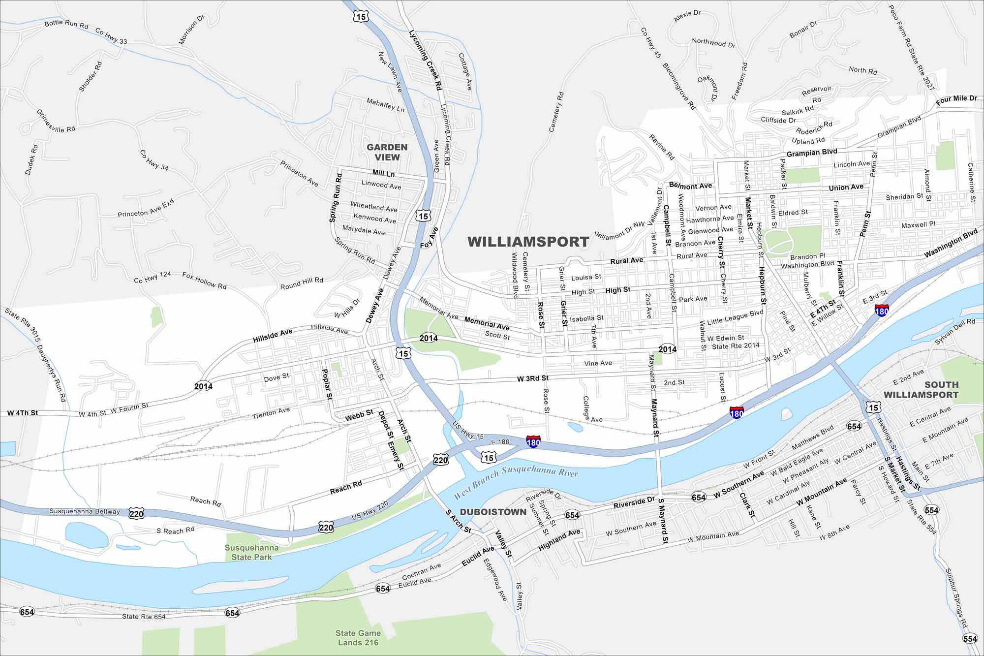
Our Williamsport map puts you in the home of Little League Baseball. Yep, that’s right. The annual tournament of the Little League Baseball World Series is here. What else? Well, the Susquehanna River also runs right through the city to the south.
Map Information
On the Map
Interstates/Highways: I-180, US Hwy 15, US Hwy 220, State Rte 654, State Rte 2014, State Rte 2027 Major Roads: Fourth St, Third St, Market St, Maynard St, Washington Blvd, Little League Blvd, Via Bella, Grampian Blvd, High St, Rural Ave, Memorial Ave, Arch St, Reach Rd, Southern Ave, Mountain Ave, Lycoming Creek Rd, Dewey Ave, Campbell St, Hepburn St, Franklin St Major Rivers: West Branch Susquehanna River Parks and Preserves: Susquehanna State Park Nearby Communities: South Williamsport, Duboistown, Garden ViewPennsylvania State Maps
Browse maps throughout the Keystone State.


City Maps of Pennsylvania
Here is our city map collection for all of Pennsylvania.


