Map of Marietta, Georgia
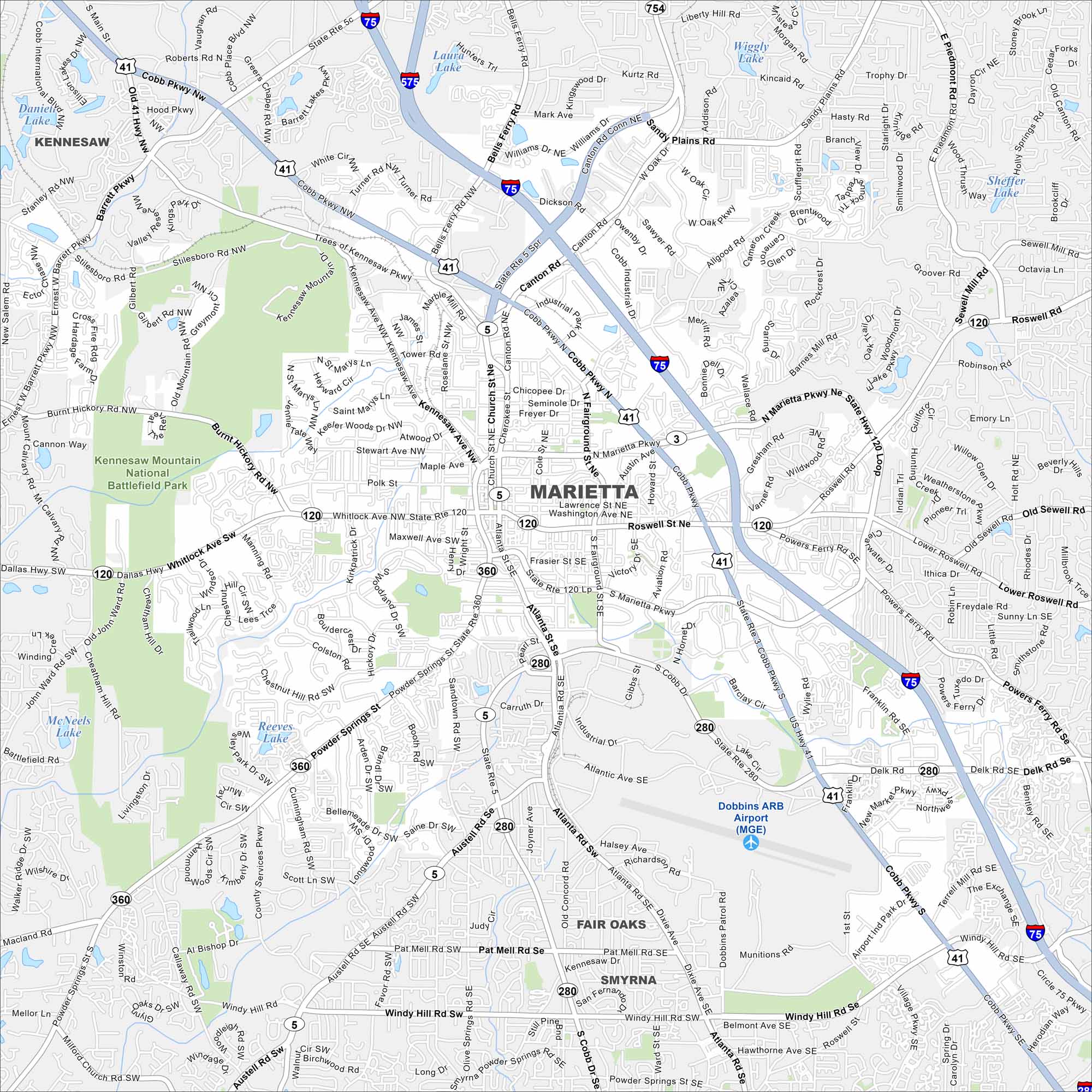
See Marietta on our road map. Interstate 75 runs beside the city, linking it with downtown. The Chattahoochee River flows to the east.
Georgia State Maps
Browse through our Georgia map collection


Map Information
On the Map
Interstates/Highways: I-75, I-575, US Hwy 41, State Rte 120, State Rte 360, State Rte 5, State Rte 280, State Rte 3 Major Roads: Cobb Pkwy, Marietta Pkwy, Whitlock Ave, Dallas Hwy, Powder Springs St, Austell Rd, Windy Hill Rd, Roswell St, Fairground St, Atlanta St, South Marietta Pkwy, North Marietta Pkwy, Delk Rd, Barrett Pkwy, Stilesboro Rd, Canton Rd, Sandy Plains Rd, Sewell Mill Rd, Scufflegrit Rd, Powers Ferry Rd Airports: Dobbins ARB Airport (MGE) Lakes and Reservoirs: Daniell Lake, Laura Lake, Wiggly Lake, Kincaid Lake, Sheffer Lake, Sewell Mill Lake, McNeels Lake, Reeves Lake Parks and Preserves: Kennesaw Mountain National Battlefield Park Nearby Communities: Kennesaw, Fair Oaks, SmyrnaGeorgia City Maps
Get to know Atlanta and Georgia’s urban areas


