Map of Milton, Georgia
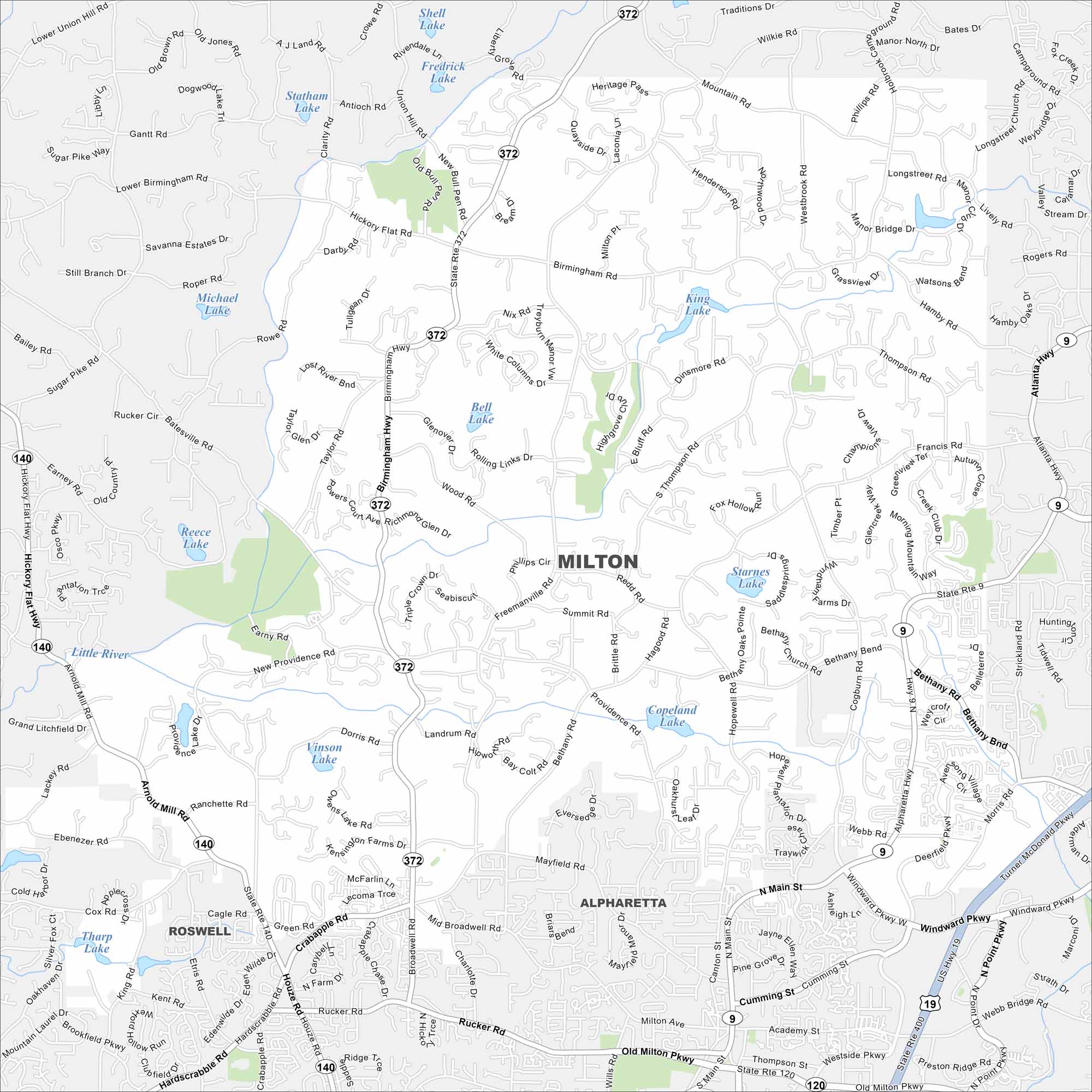
Learn about Milton with our road map. Rolling hills, horse farms, and neighborhoods dominate the landscape. It’s one of metro Atlanta’s more rural-feeling suburbs.
Georgia State Maps
Browse through our Georgia map collection


Map Information
On the Map
Interstates/Highways: US Hwy 19, State Rte 400, State Rte 372, State Rte 140, State Rte 9, State Rte 120, Birmingham Hwy Major Roads: Arnold Mill Rd, Crabapple Rd, Houze Rd, Mayfield Rd, Freemanville Rd, Providence Rd, Bethany Rd, Hopewell Rd, Windward Pkwy, Mid Broadwell Rd, Rucker Rd, Webb Rd, Cogburn Rd, Francis Rd, Thompson Rd, Birmingham Rd, Henderson Rd, Longstreet Rd, Phillips Cir Lakes and Reservoirs: Shell Lake, Fredrick Lake, Statham Lake, Michael Lake, King Lake, Bell Lake, Starnes Lake, Copeland Lake, Vinson Lake, Tharp Lake Major Rivers: Little River Nearby Communities: Alpharetta, RoswellGeorgia City Maps
Get to know Atlanta and Georgia’s urban areas


