Map of New Castle, Pennsylvania
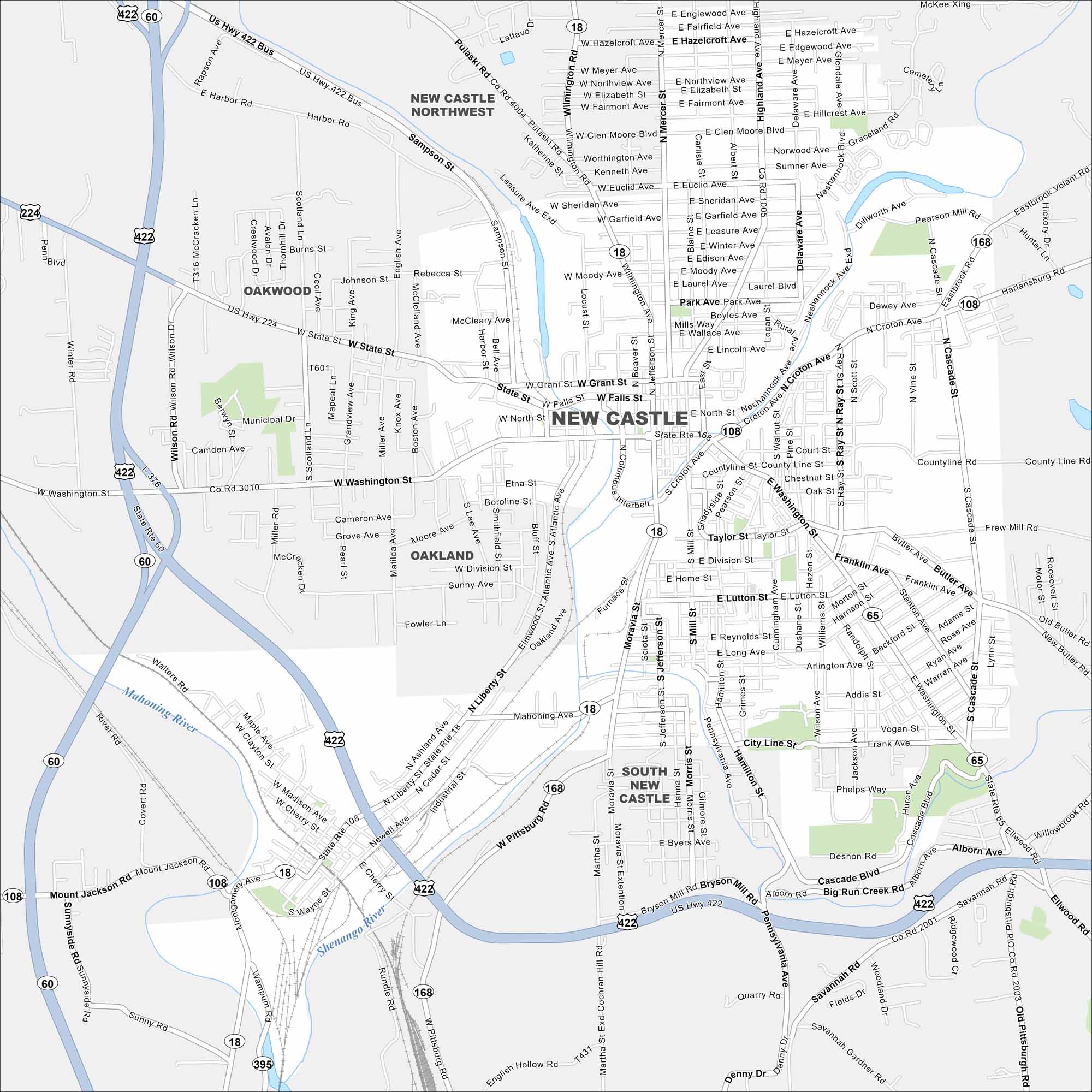
New Castle lies near the Ohio border in western Pennsylvania. Our map shows a compact downtown, river crossings, and neighborhoods on rolling hills. The city has long been tied to the steel industry.
Map Information
On the Map
Interstates/Highways: US Hwy 422, US Hwy 422 Bus, US Hwy 224, State Rte 18, State Rte 60, State Rte 65, State Rte 108, State Rte 168 Major Roads: State St, Washington St, Jefferson St, Wilmington Rd, Pulaski Rd, Sampson St, Grant St, Falls St, Croton Ave, Butler Ave, Cascade Blvd, Savannah Rd, Pittsburgh Rd, Liberty St, Atlantic Ave, Mahoning Ave, Highland Ave, Mercer St, Ellwood Rd, West State St Major Rivers: Shenango River, Mahoning River Nearby Communities: Oakwood, Oakland, New Castle Northwest, South New CastlePennsylvania State Maps
Browse maps throughout the Keystone State.


City Maps of Pennsylvania
Here is our city map collection for all of Pennsylvania.


