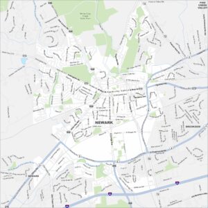
Map of Newark, Delaware
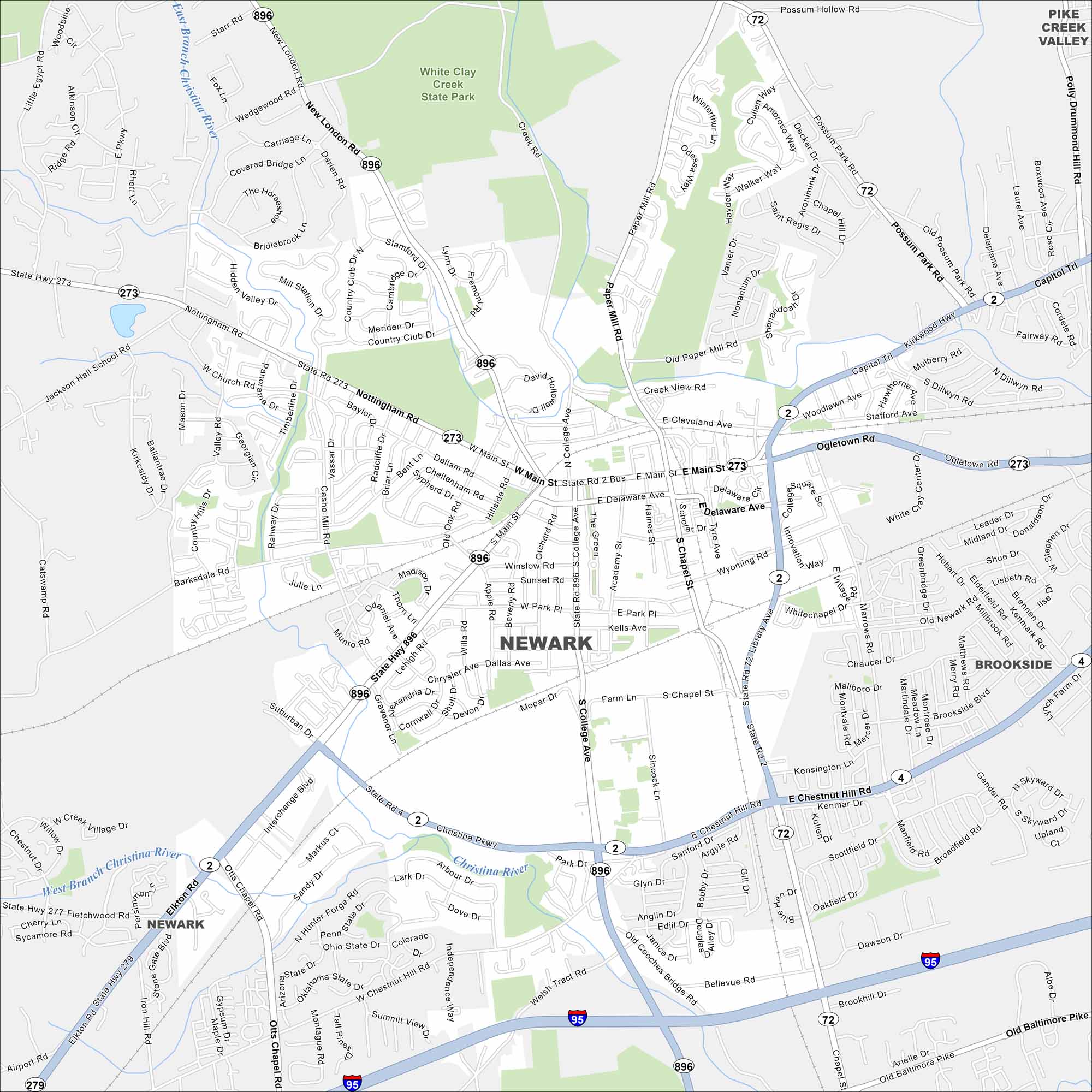
Our map of Newark highlights a small city anchored by the University of Delaware. The Christina River winds nearby and so does Interstate 95. It’s a hub for students and commuters.
Map Information
On the Map
Interstates/Highways: I-95, US Hwy 896, State Rte 2, State Rte 4, State Rte 72, State Rte 273, State Rte 279 Major Roads: Main St, Delaware Ave, College Ave, Library Ave, Cleveland Ave, Capitol Trl, Kirkwood Hwy, Elkton Rd, Christina Pkwy, Chestnut Hill Rd, Old Baltimore Pike, Paper Mill Rd, New London Rd, Nottingham Rd, Barksdale Rd, Marrows Rd, Otts Chapel Rd, Welsh Tract Rd, Possum Park Rd, Polly Drummond Hill Rd Major Rivers: Christina River Parks and Forests: White Clay Creek State Park Nearby Communities: Brookside, Pike Creek ValleyDelaware City Maps
Find Wilmington and maps of Delaware’s cities here