Map of Reading, Pennsylvania
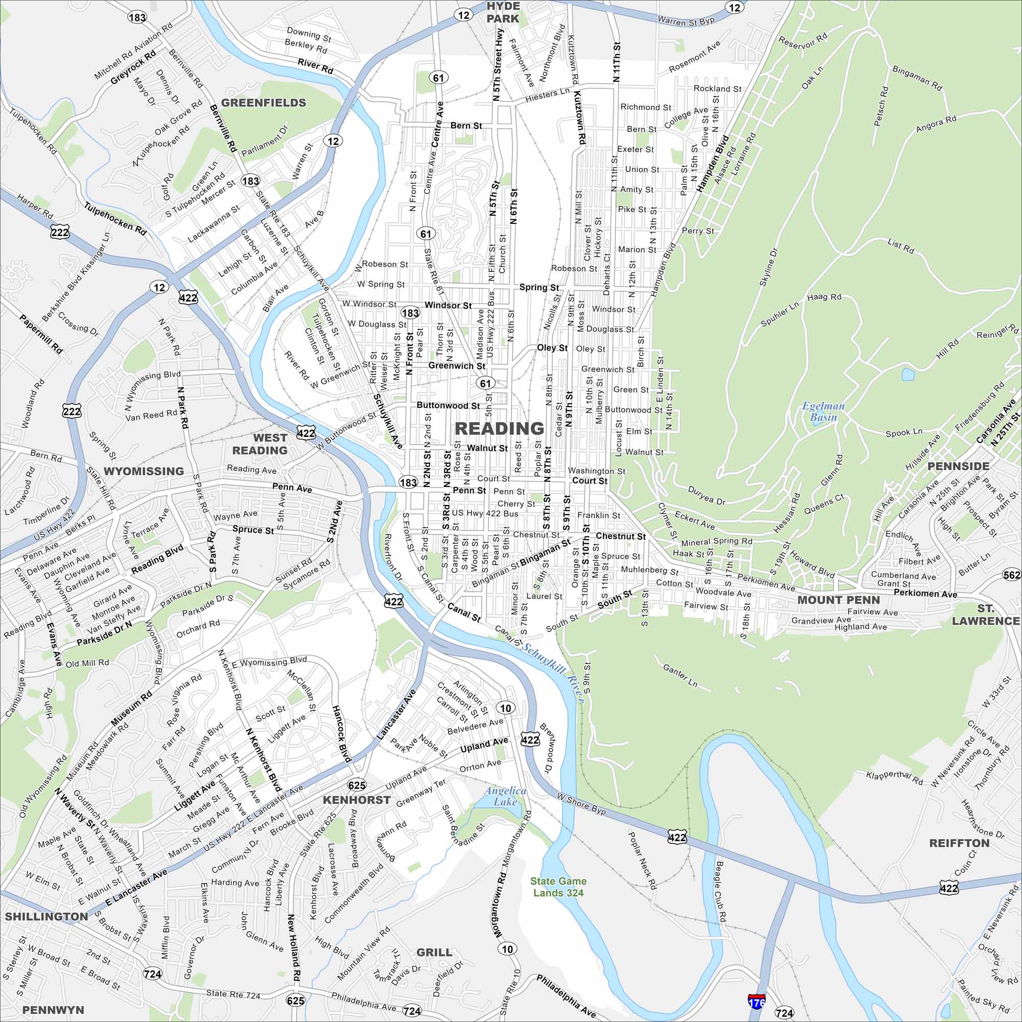
Reading sits along the Schuylkill River and has a strong industrial past. This map highlights its main roads, parks, and surrounding hills.
Map Information
On the Map
Interstates/Highways: I-176, US Hwy 222, US Hwy 422, State Rte 10, State Rte 12, State Rte 183, State Rte 625, State Rte 724 Major Roads: Penn St, Perkiomen Ave, Lancaster Ave, Morgantown Rd, Warren St Byp, Fifth St, Ninth St, Centre Ave, Bingaman St, Buttonwood St, Greenwich St, Oley St, Spring St, Mineral Spring Rd, Museum Rd, Parkside Dr, Wyomissing Blvd Lakes and Reservoirs: Egelman Basin, Angelica Lake Major Rivers: Schuylkill River Nearby Communities: West Reading, Wyomissing, Shillington, Kenhorst, Grill, Mount Penn, Saint Lawrence, Pennside, Hyde Park, GreenfieldsPennsylvania State Maps
Browse maps throughout the Keystone State.


City Maps of Pennsylvania
Here is our city map collection for all of Pennsylvania.


