Map of Roswell, Georgia
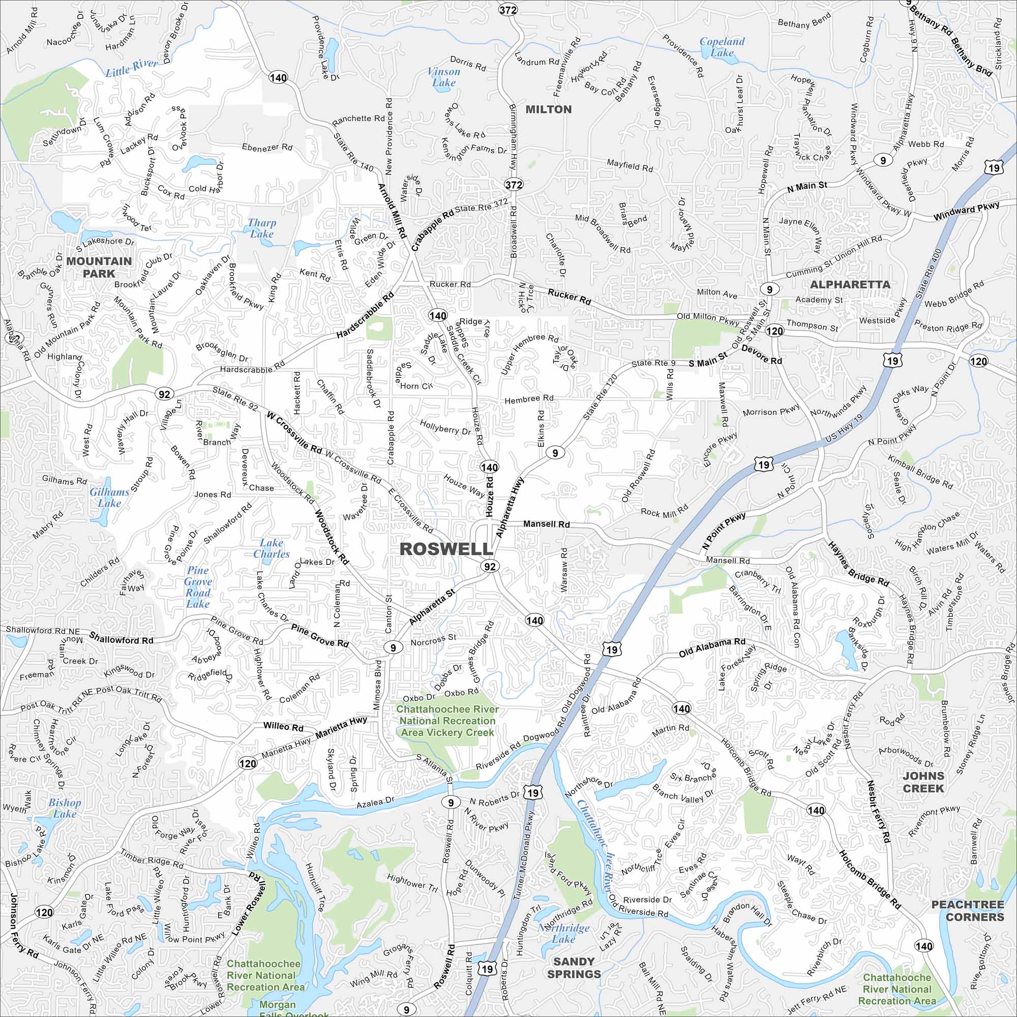
This street map of Roswell highlights the historic district and the Chattahoochee River. You’ll see how neighborhoods branch out from downtown. It’s a city full of history and green spaces.
Georgia State Maps
Browse through our Georgia map collection


Map Information
On the Map
Interstates/Highways: US Hwy 19, State Rte 400, State Rte 9, State Rte 92, State Rte 120, State Rte 140, State Rte 372, Alpharetta Hwy Major Roads: Holcomb Bridge Rd, Mansell Rd, Crossville Rd, Marietta Hwy, E Crossville Rd, W Crossville Rd, N Main St, S Main St, Houze Rd, Arnold Mill Rd, Crabapple Rd, Woodstock Rd, Hardscrabble Rd, Willeo Rd, Riverside Rd, Old Alabama Rd, Grimes Bridge Rd, Warsaw Rd, Nesbit Ferry Rd Lakes and Reservoirs: Copeland Lake, Vinson Lake, Tharp Lake, Gilhams Lake, Lake Charles, Pine Grove Road Lake, Bishop Lake, Northridge Lake Major Rivers: Chattahoochee River Parks and Preserves: Chattahoochee River National Recreation Area Nearby Communities: Alpharetta, Milton, Mountain Park, Johns Creek, Peachtree Corners, Sandy SpringsGeorgia City Maps
Get to know Atlanta and Georgia’s urban areas


