Map of Scranton, Pennsylvania
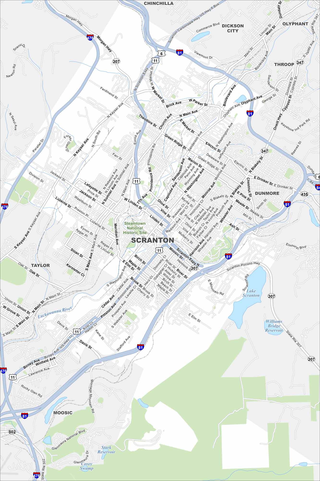
I know Scranton from “The Office”. But you can get to know Scranton with our road map. From the Steamtown National Historic Site to downtown blocks, it shows the best ways around this valley city.
Map Information
On the Map
Interstates/Highways: I-81, I-84, I-476, US Hwy 6, US Hwy 11, State Rte 307, State Rte 347, State Rte 435, State Rte 502 Major Roads: Main Ave, Market St, Providence Rd, Wyoming Ave, Washington Ave, Keyser Ave, Moosic St, Pittston Ave, Cedar Ave, Birch St, Davis St, Lackawanna Ave, Expressway, Morgan Hwy, Boulevard Ave, Electric St, Green Ridge St, Drinker St, Montage Mountain Blvd, Birney Ave Lakes and Reservoirs: Lake Scranton, Williams Bridge Reservoir, Stark Reservoir Major Rivers: Lackawanna River Parks and Preserves: Steamtown National Historic Site Nearby Communities: Dickson City, Olyphant, Throop, Dunmore, Moosic, Taylor, ChinchillaPennsylvania State Maps
Browse maps throughout the Keystone State.


City Maps of Pennsylvania
Here is our city map collection for all of Pennsylvania.


