US Elevation Map
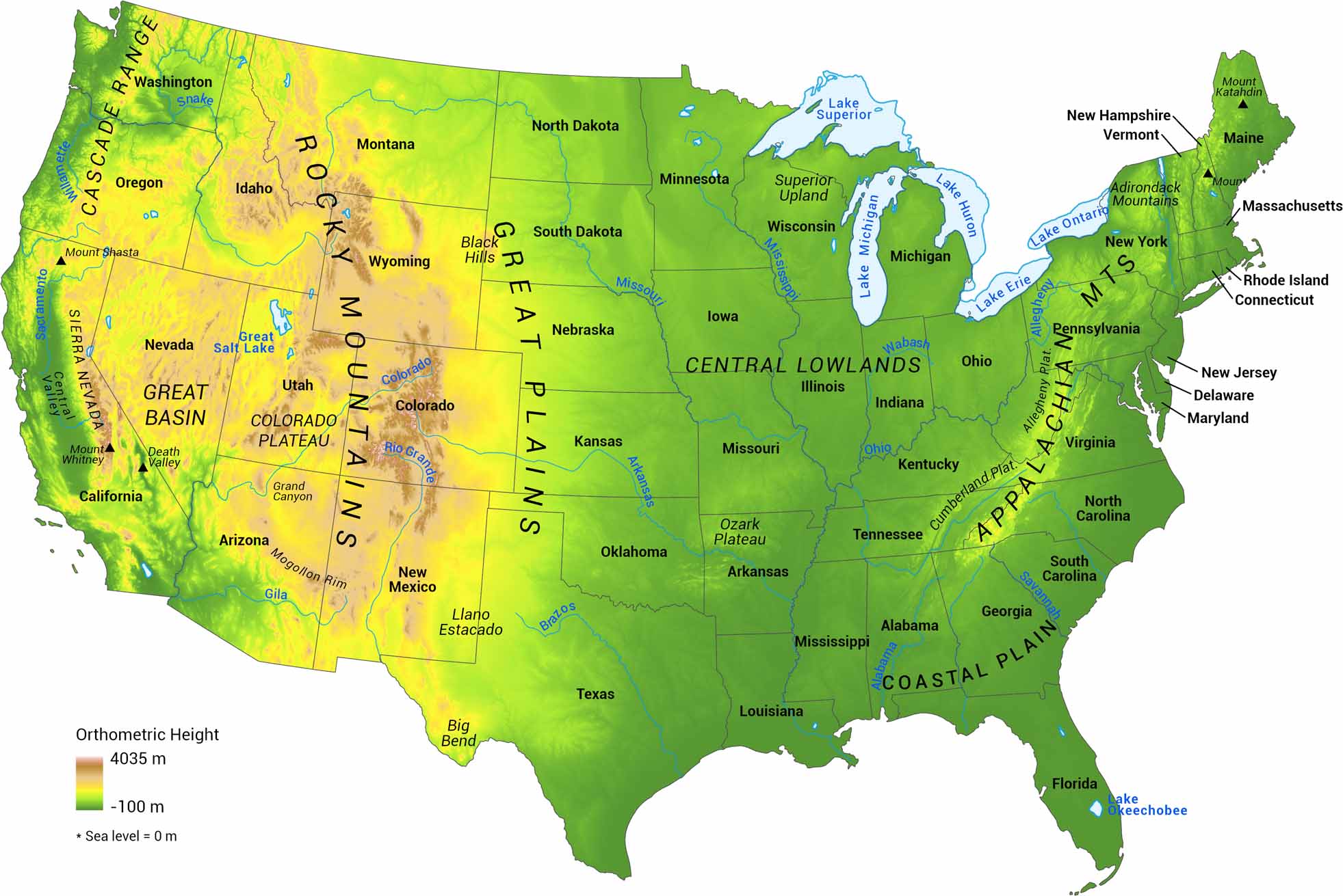
Elevation in the United States ranges from sea level to high mountain peaks. Our US elevation map shows those changes using meters as the scale. We’ve mapped sea level as zero, with the highest elevations at the Rocky Mountains.
Map Information