Map of St. Marys, Georgia
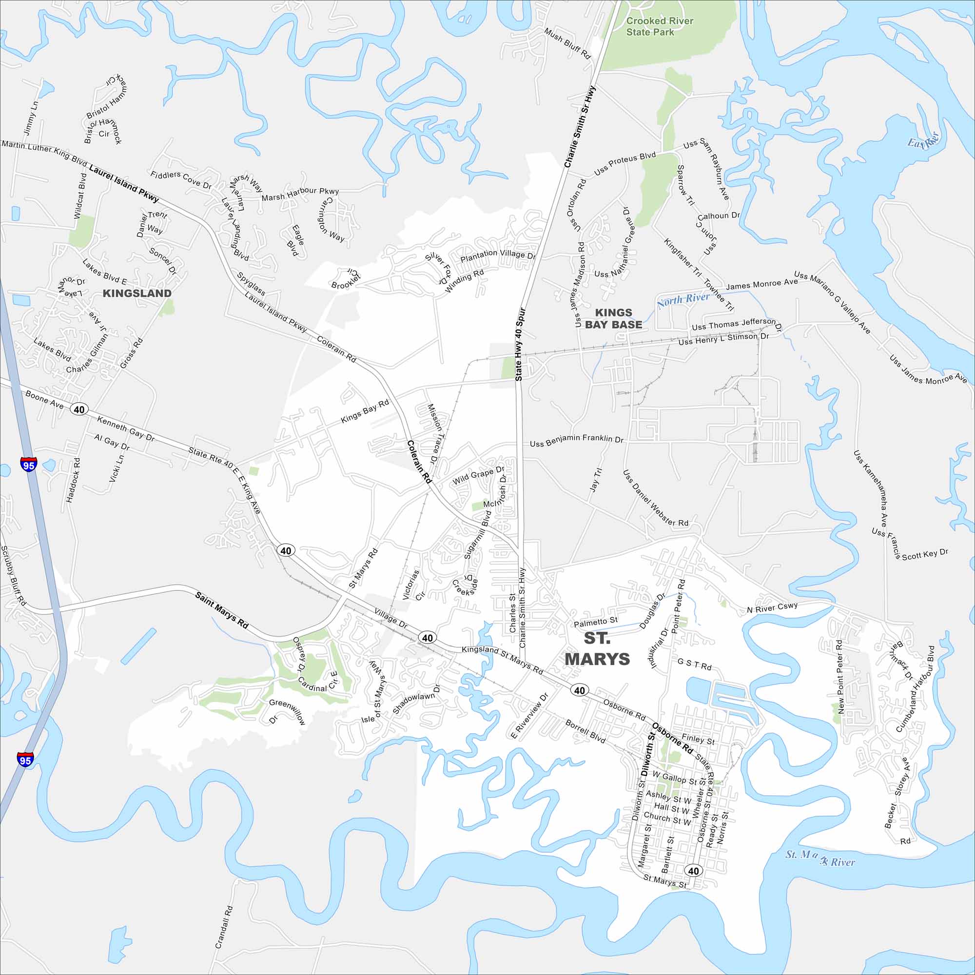
St. Marys is a quiet coastal town near the Florida line. Our map helps you explore its historic waterfront and the gateway to Cumberland Island.
Georgia State Maps
Browse through our Georgia map collection


Map Information
On the Map
Interstates/Highways: I-95, State Rte 40 Major Roads: Osborne Rd, St Marys Rd, Kings Bay Rd, Colerain Rd, Laurel Island Pkwy, Charlie Smith Sr Hwy, Dilworth St, Point Peter Rd, Haddock Rd, Gross Rd, Lakes Blvd, Boone Ave, Scrubby Bluff Rd, Martin Luther King Blvd, Plantation Village Dr, G St Rd, Ready St, Borrell Blvd, W Gallop St, Dandy St Major Rivers: North River, St Marys River Parks and Preserves: Crooked River State Park Nearby Communities: Kingsland, Kings Bay BaseGeorgia City Maps
Get to know Atlanta and Georgia’s urban areas


