Map of Statesboro, Georgia
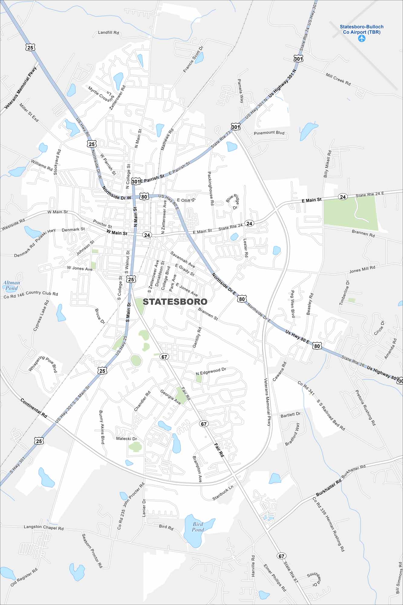
Here’s our map of Statesboro, a city tied closely to Georgia Southern University. US-80 and US-25 are the major highways here. Downtown has a mix of shops, music, and local dining.
Georgia State Maps
Browse through our Georgia map collection


Map Information
On the Map
Interstates/Highways: US Hwy 80, US Hwy 301, US Hwy 25, State Rte 67, State Rte 24, State Rte 26, State Rte 73 Major Roads: Main St, Northside Dr, Veterans Memorial Pkwy, Fair Rd, Brannen Rd, Parrish St, Zetterower Ave, Gentilly Rd, Cawana Rd, Burkhalter Rd, Langston Chapel Rd, Chandler Rd, Pulaski Hwy, Westside Rd, Pretoria Rushing Rd, Herman Rushing Rd, Cypress Lake Rd, Country Club Rd, S Zetterower Ave Airports: Statesboro-Bulloch Co Airport (TBR) Lakes and Reservoirs: Bird Pond, Altman PondGeorgia City Maps
Get to know Atlanta and Georgia’s urban areas


