Union Station DC Map
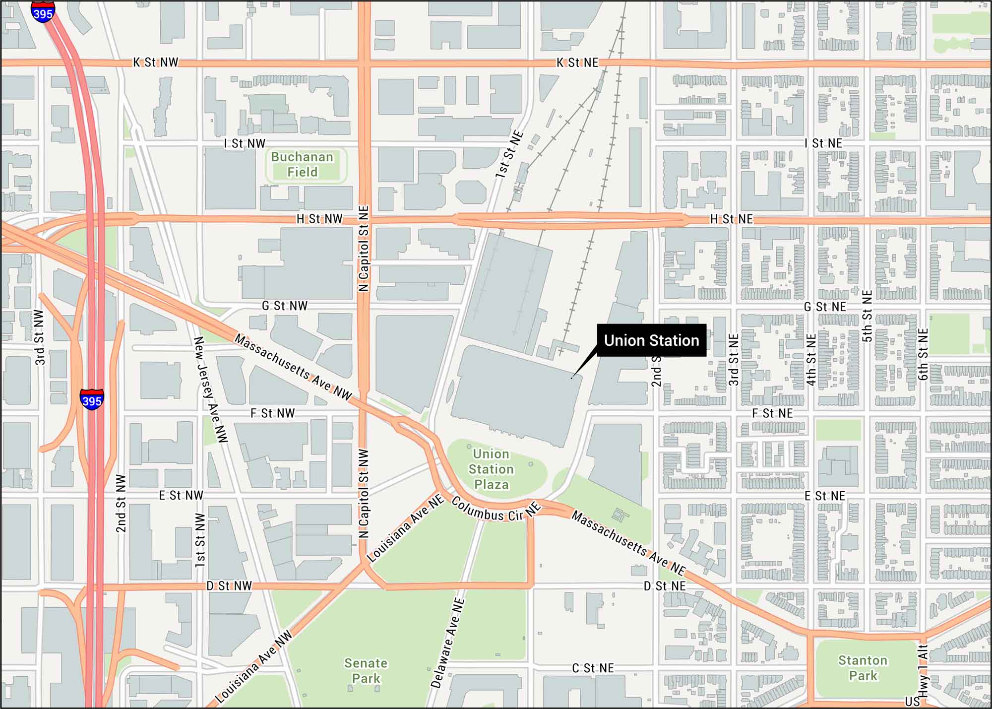
Step into Washington’s historic Union Station. Our map shows streets like Massachusetts Avenue and Columbus Circle. It sits just blocks from the U.S. Capitol.
Map Information
On the Map
Interstates/Highways: I-395 Major Roads: Massachusetts Ave, H St, K St, Louisiana Ave, Capitol St, New Jersey Ave, 1st St, 2nd St, 3rd St, 4th St, 5th St, 6th St, Columbus Cir, Delaware Ave, G St, F St, E St, D St, C St Parks/Forests: Union Station Plaza, Senate Park, Stanton Park Other Landmarks: Buchanan FieldTourist Maps in District of Columbia
Discover all the prime locations with our tourist maps.