Minneapolis–Saint Paul International Airport Map

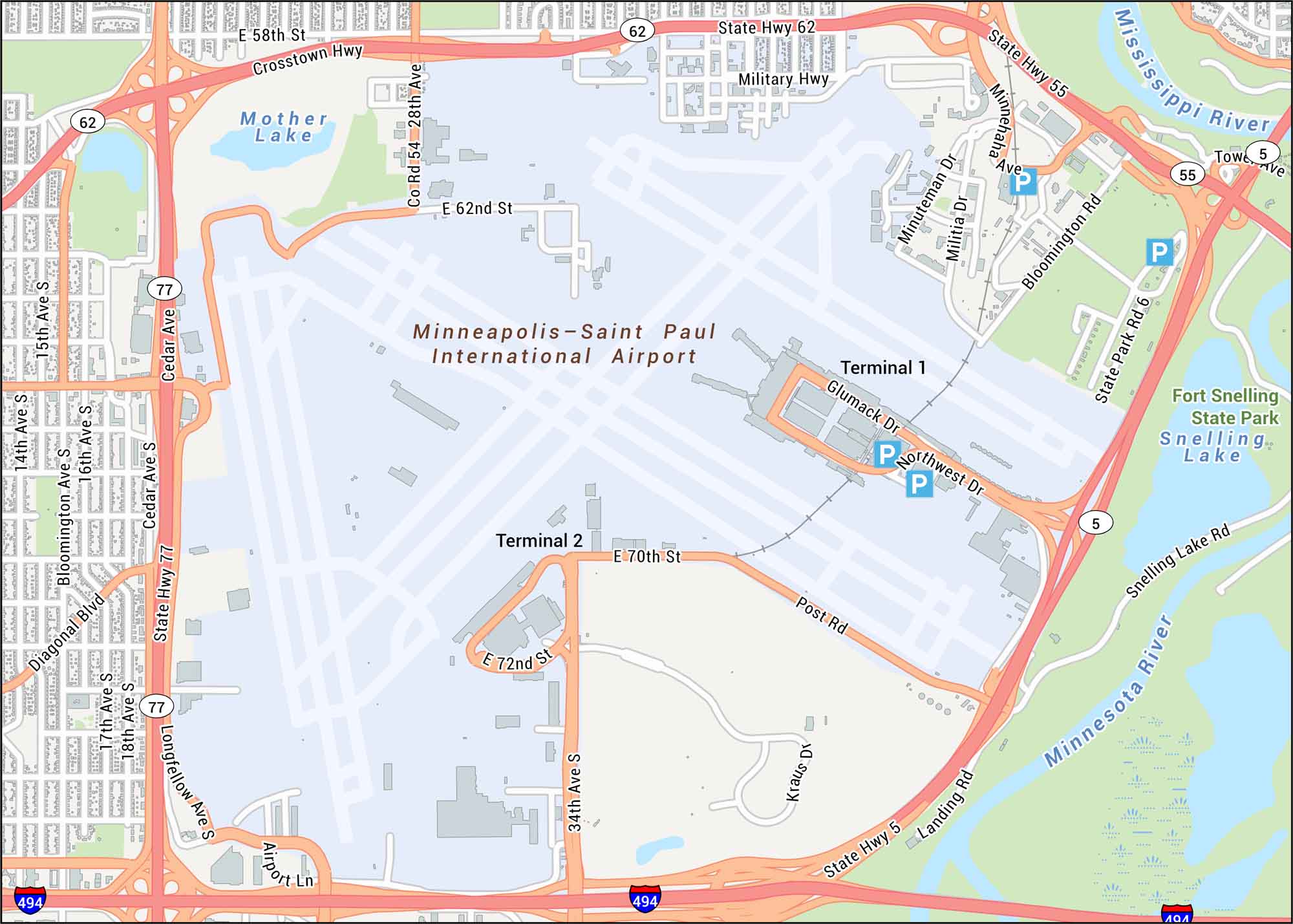
Get a snapshot of Minneapolis–Saint Paul International Airport. Our map features its runways, terminals, and surrounding highways/roads. The airport sits between the Twin Cities, right along the Mississippi River’s broad valley.
Map Information
On the Map
Interstates/Highways: I-494, State Hwy 62, State Hwy 77, State Hwy 55, State Hwy 5, Crosstown Hwy Major Roads: 34th Ave S, Glumack Dr, Post Rd, Cedar Ave, Bloomington Rd, Minnehaha Ave, 28th Ave, Military Hwy, Snelling Lake Rd, 15th Ave, 18th Ave, Northwest Dr, E 70th St, E 72nd St, E 62nd St, E 58th St, Diagonal Blvd, Longfellow Ave, Kraus Dr Rivers/Lakes: Mississippi River, Minnesota River, Snelling Lake, Mother Lake Parks/Forests: Fort Snelling State Park Other Landmarks: Terminal 1, Terminal 2Tourist Maps in Minnesota
Discover all the prime locations with our tourist maps.
No posts