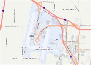
Home » Tourist Maps » Lambert Airport Map

Lambert Airport Map

Lambert Airport Map

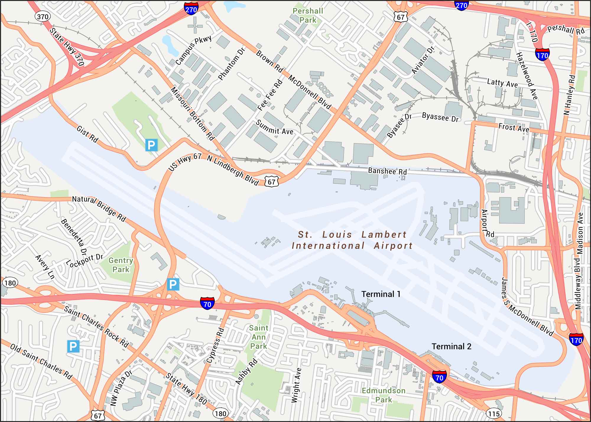
Lambert Airport is shown here with its terminals, runways, and the roads that feed into each concourse. Our map gives you a clean view of the airport’s nearby highways, which serves St. Louis.

Map Information

  • St. Louis Lambert International Airport
  • Map of Lambert International Airport
  • Free for personal and commercial purpose. Attribution is required. How to attribute?

On the Map

Interstates/Highways: I-70, I-170, I-270, US Hwy 67, State Hwy 370, State Hwy 180 Major Roads: Lindbergh Blvd, McDonnell Blvd, Natural Bridge Rd, Saint Charles Rock Rd, Missouri Bottom Rd, Airport Rd, James S McDonnell Blvd, Hanley Rd, Madison Ave, Middleway Blvd, Pershall Rd, Brown Rd, Fee Fee Rd, Gist Rd, Cypress Rd, Ashby Rd, Wright Ave, Campus Pkwy, Phantom Dr, Aviator Dr Parks/Forests: Pershall Park, Gentry Park, Saint Ann Park, Edmundson Park Other Landmarks: St. Louis Lambert International Airport, Terminal 1, Terminal 2

References

Leave a Reply

Your email address will not be published. Required fields are marked *