Dulles International Airport Map
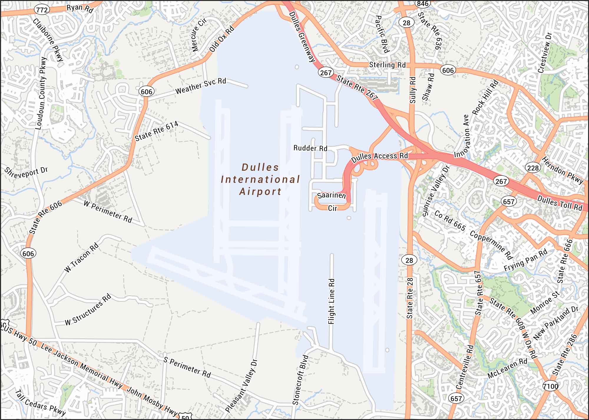
Fly through Dulles with our map. Located west of Washington, D.C., this airport handles millions of travelers yearly. Our map shows terminals, runways and highways.
Map Information
On the Map
Interstates/Highways: US Hwy 50, State Rte 267, State Rte 28, State Rte 606, State Rte 657, State Rte 666, State Rte 608, State Rte 286
Major Roads: Dulles Greenway, Dulles Toll Rd, Dulles Access Rd, Lee Jackson Memorial Hwy, John Mosby Hwy, Loudoun County Pkwy, Claiborne Pkwy, Sterling Rd, Herndon Pkwy, Centreville Rd, Sunrise Valley Dr, Pacific Blvd, Sully Rd, Shaw Rd, Innovation Ave, Rock Hill Rd, Frying Pan Rd, Pleasant Valley Dr
Tourist Maps in District of Columbia
Discover all the prime locations with our tourist maps.
