Denver International Airport Map
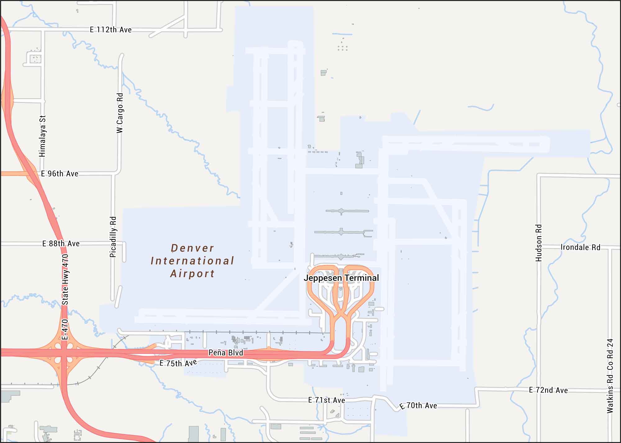
Here’s our Denver International Airport map, which sits northeast of Denver. Our map shows runways, nearby highways, and local streets.
Map Information
On the Map
Interstates/Highways: State Hwy 470, E-470 Major Roads: Pena Blvd, Piccadilly Rd, Hudson Rd, Watkins Rd Co Rd 24, E 112th Ave, E 96th Ave, E 88th Ave, E 75th Ave, E 72nd Ave, E 71st Ave, E 70th Ave, Himalaya St, W Cargo Rd, Irondale Rd Other Landmarks: Jeppesen TerminalTourist Maps in Colorado
Discover all the prime locations with our tourist maps.