Twin Cities Map
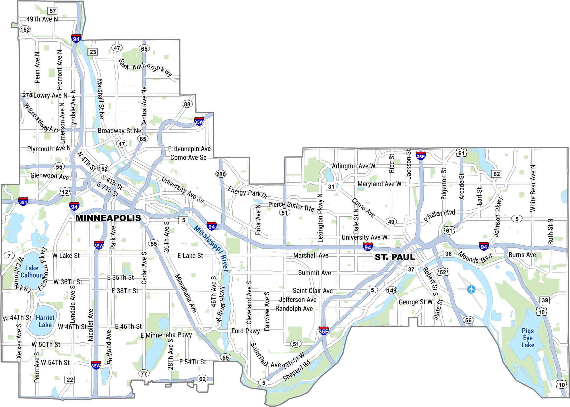
Our map of the Twin Cities lays out Minneapolis and St. Paul side by side, split by the Mississippi River. It shows main roads, lakes, parks, and the stretches that tie both downtowns together. Two cities. One awesome atmosphere.
Map Information
On the Map
Interstates/Highways: I-35E, I-35W, I-94, I-394, I-280, US Hwy 10, US Hwy 12, US Hwy 52, US Hwy 61 State Routes: State Rte 5, State Rte 7, State Rte 13, State Rte 22, State Rte 31, State Rte 36, State Rte 37, State Rte 39, State Rte 47, State Rte 49, State Rte 51, State Rte 55, State Rte 56, State Rte 57, State Rte 62, State Rte 65, State Rte 77, State Rte 88, State Rte 149, State Rte 152, State Rte 278 Major Roads: University Ave, Broadway St, Hennepin Ave, Lake St, Marshall Ave, Snelling Ave, Rice St, Robert St, Summit Ave, Hiawatha Ave, Lyndale Ave, Nicollet Ave, Central Ave, Como Ave, Ford Pkwy, Minnehaha Pkwy, Shepard Rd, Phalen Blvd, Johnson Pkwy, Lexington Pkwy Lakes/Rivers: Mississippi River, Lake Calhoun, Harriet Lake, Pigs Eye LakeTwin Cities Maps
See individual maps for both Minneapolis and St. Paul, Minnesota.

