Map of Valdosta, Georgia
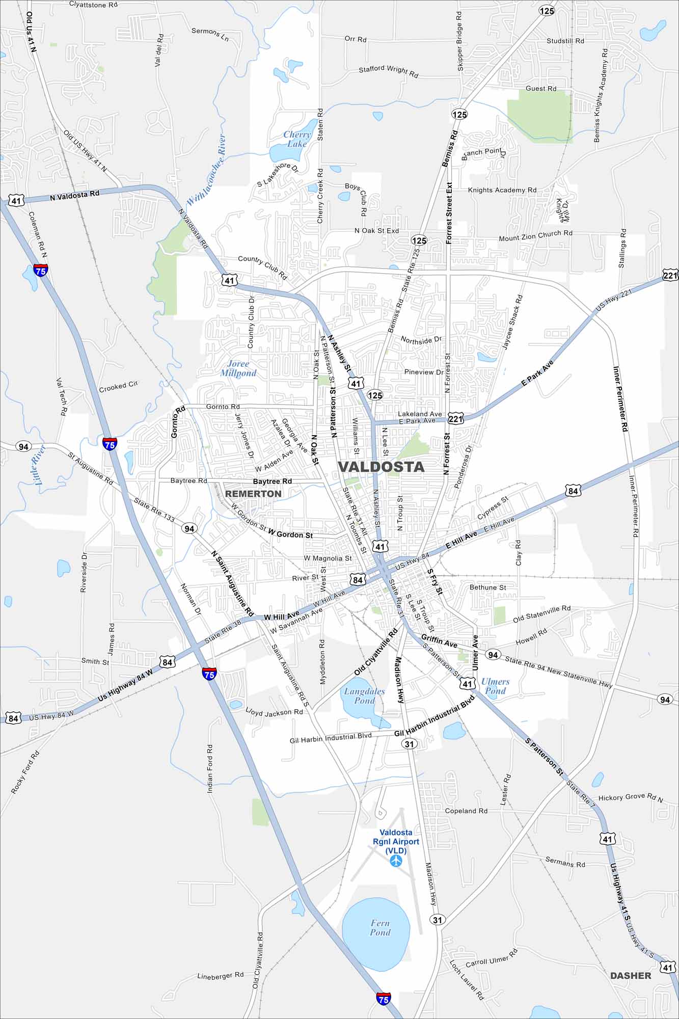
Valdosta is a South Georgia hub known as the “Azalea City”. Our map shows ponds/lakes like Fern and Langdales Pond. You can also see all the streets part of its historic downtown.
Georgia State Maps
Browse through our Georgia map collection


Map Information
On the Map
Interstates/Highways: I-75, US Hwy 41, US Hwy 84, US Hwy 221, State Rte 125, State Rte 31, State Rte 94, State Rte 133, State Rte 38 Major Roads: Inner Perimeter Rd, Ashley St, Patterson St, Valdosta Rd, Baytree Rd, Hill Ave, Gornto Rd, St Augustine Rd, Madison Hwy, Old Clyattville Rd, Gil Harbin Industrial Blvd, Bemiss Rd, Park Ave, Lakeland Ave, Forrest St, Norman Dr, James Rd, Jerry Jones Dr, Azalea Dr, Williams St Airports: Valdosta Rgnl Airport (VLD) Lakes and Reservoirs: Langdales Pond, Fern Pond, Cherry Lake, Ulmers Pond Major Rivers: Withlacoochee River, Little River Nearby Communities: Remerton, DasherGeorgia City Maps
Get to know Atlanta and Georgia’s urban areas


