Map of Villa Rica, Georgia
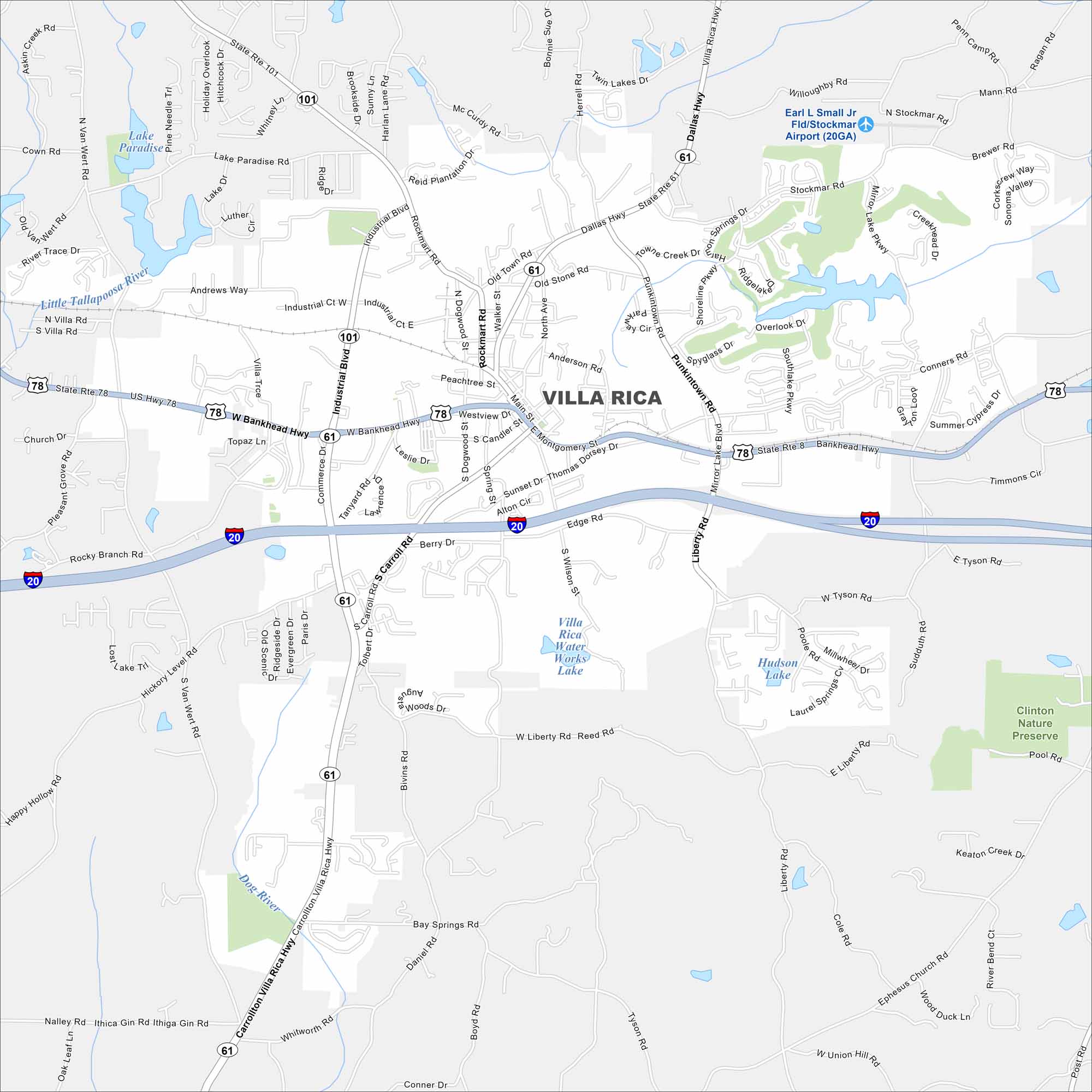
Our Villa Rica map highlights this historic gold-mining town. Today it’s a growing community west of Atlanta with deep roots. I-20 also cuts right through east to west.
Georgia State Maps
Browse through our Georgia map collection


Map Information
On the Map
Interstates/Highways: I-20, US Hwy 78, State Rte 61, State Rte 101, State Rte 8, Dallas Hwy, Bankhead Hwy Major Roads: Main St, Industrial Blvd, Commerce Dr, Carrollton Villa Rica Hwy, Mirror Lake Blvd, Punkintown Rd, Shoreline Pkwy, Liberty Rd, Stockmar Rd, Tyson Rd, Ephesus Church Rd, Bay Springs Rd, Edge Rd, Connors Rd, Douglas St, Rockmart Rd, North Ave, Wilson St Airports: Earl L Small Jr Fld/Stockmar Airport (20GA) Lakes and Reservoirs: Mirror Lake, Lake Paradise, Villa Rica Water Works Lake, Hudson Lake Major Rivers: Little Tallapoosa River, Dog River Parks and Preserves: Clinton Nature PreserveGeorgia City Maps
Get to know Atlanta and Georgia’s urban areas


